2D Plans exported using 3D Scanners9633
Pages:
1|
|
VaughanHarris private msg quote post Address this user | |
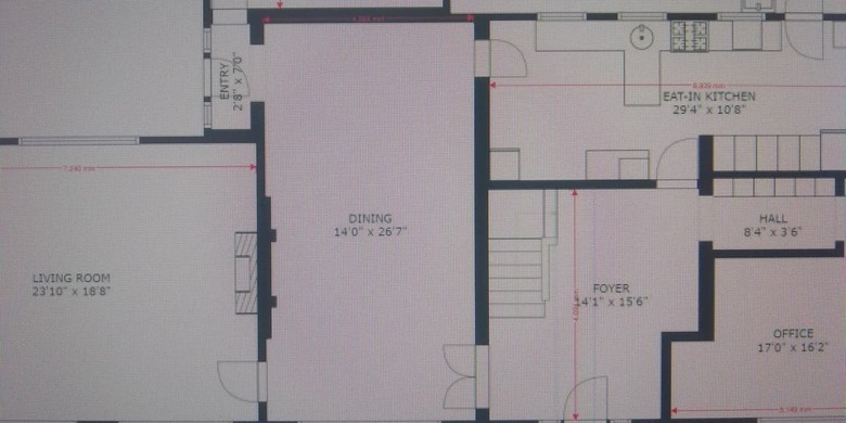
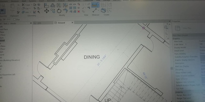
| For those of you who might be interested in 2D plans from 3D cameras. We did a Matterport Pro scan, GeoCv and Leica S6200 point cloud scan on a house. The GeoCV 2D floor plan was less than half an inch difference to Leica point cloud measurement once converted from Recap to Revit. MP scan was sent back due to layout discrepancy and even on the 2nd submission, the MP measurement was completely off. Attach is the GeoCV 2D plan and the Revit floor plan measurement. | ||
| Post 1 • IP flag post | ||
 WGAN WGAN Basic Member Boston |
Noddy private msg quote post Address this user | |
| Thanks VaughanHarris, very interesting test! I didn't see any attachments come through though, could you re-post the plans? |
||
| Post 2 • IP flag post | ||
|
|
VaughanHarris private msg quote post Address this user | |
| I have attached the PDF we received from GeoCV, we used Bluebeam Revu to calibrate and check the measurement. The other image attached is the measurement check-in Revit 19 once imported from Recap. Unfortunately, the MP image was not made available as they couldn't repair the plan layout due to a technical error on their side.   |
||
| Post 3 • IP flag post | ||
Pages:
1This topic is archived. Start new topic?


