Brain Teaser: Why 4 Floors When Only 2?5234
Pages:
1
 WGAN Forum WGAN ForumFounder & WGAN-TV Podcast Host Atlanta, Georgia |
DanSmigrod private msg quote post Address this user | |
Video: Courtesy of We Get Around Atlanta Hi MatterPeep Masters, Here's some background before the Brainer Teaser questions: I scanned a Virtual Reality Agency loft in Atlanta Tuesday (15 August 2017). ✓ 273 scans ✓ 7 hours ✓ about 2,500 SQ FT Brain Teaser 1. It's a 2 story loft: why did I create 4 floors in the Capture app? 2. This space could have easily been scanned in 2.5 hours. Some might say an hour. Why did I take 7 (by choice)? 3. What's the use case? Hint: our client cares about the data Note: There is more than one right answer for use case (the client has two different uses). Your answers by 5 pm ET this Friday (18 August 2017). I will post the answers over the weekend. Prize? Zip. Nada. Just fame among your MatterPeeps and and a shout-out during a WGAN-TV Live at 5 show Best, Dan |
||
| Post 1 • IP flag post | ||

Hartland, Wisconsin |
htimsabbub23 private msg quote post Address this user | |
| This scan will be used to create a virtual reality world which then they will overlay in a game to make it almost like AG. Dressing up any of the structure with unique disguises. | ||
| Post 2 • IP flag post | ||
 WGAN Forum WGAN ForumFounder & WGAN-TV Podcast Host Atlanta, Georgia |
DanSmigrod private msg quote post Address this user | |
| @htimsabbub23 Wow! You're great! We will count this as one use. The client wanted a dense mesh to model in unity to create a game using their office. So, I scanned the Space the equivalent of 3-4 times normal. 1. What are other use cases for this same model? Client has at least one more use case. 2. It's only two levels. Why did I create four levels on my iPad and how did that affect the processing? Dan |
||
| Post 3 • IP flag post | ||
|
|
aerialpixels private msg quote post Address this user | |
| does scanning more times really give: 1) a desnser point cloud? (well yes does sound logical) 2) a higher res OBJ file ? (this one i really am not sure, since MP control the meshing up of the point cloud to the OBJ) |
||
| Post 4 • IP flag post | ||

Frisco, Texas |
Metroplex360 private msg quote post Address this user | |
| Wouldn't it be neat if Capture had a 'Expert Mode' that would provide feedback on how much NEW data was added to the mesh from each scan? I do not know if it's possible while scanning - but it would be interesting if while scanning this, messages like: '10 New Triangles Added' would have appeared in a console window. My opinion on this scan is that the redundant scans did not always add more data to the mesh. Dan, what might be nice is if you made a copy of this and removed half of the scans and then passed it along to one of our many 3D pros here to analyze the difference to see if scanning at this depth produces greater results - and if so, to what degree (A quantification). What do you think? |
||
| Post 5 • IP flag post | ||
 WGAN Forum WGAN ForumFounder & WGAN-TV Podcast Host Atlanta, Georgia |
DanSmigrod private msg quote post Address this user | |
Quote:Originally Posted by Metroplex360 That's cool. Hopefully, the AEC time will like (and lobby) for this feature. Quote: Originally Posted by @Metroplex360 Great idea. Any takers? -- @aerialpixels @htimsabbub23 The Space is only two levels. Why did I create four levels on my iPad and how did that affect the processing? Dan |
||
| Post 6 • IP flag post | ||

Hartland, Wisconsin |
htimsabbub23 private msg quote post Address this user | |
| In order to get the most possible mesh you placed the camera on top of the tables both on the ground floor and upper level. this would then allow them to use this in the game as crates or other items to jump on top of? | ||
| Post 7 • IP flag post | ||
 WGAN Forum WGAN ForumFounder & WGAN-TV Podcast Host Atlanta, Georgia |
DanSmigrod private msg quote post Address this user | |
| @htimsabbub23 Yes. You're on the money! For clarification, I raised the camera to the highest setting on the trip to help "reach" the duck work. I lowered the camera to its lowest setting to scan under some tables and some VR Viewers in "cubby holes" ... Now imagine that I did 50 scans on the 1st level and 50 scans on the loft level and now wanted to add 50 scans to each level. BUT, how would I know where I scanned, since the Camera would be in some of the same places. It would get very confusing. SO, I created a second 1st floor and a second loft level in the Capture app so that I could see the high/low scans - separately from the "normal" scans. And, because "Floors" are ONLY for the Matterport Pro - has nothing to do with how models process - creating these additional floor plans made scanning easier without affecting the result. Here are screen grabs of the floors ... (Reminder that I was scanning for the "mesh" - not for the walk around experience. Thus, you see so many scans. Yes. If I was scanning this Space, "just" for the Matterport Spaces 3D Tour, I could have done it with a ton less scans and in a fraction of the seven hours. ...) By the way, the additional use case is that the client wants to re-configure the space (such as adding walls, desks), etc. Rather than taking pictures and measuring everything, he will "build" on top of the data. Dan P.S. How about starting a new discussion with a Brain Twister of your own? 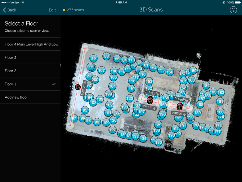 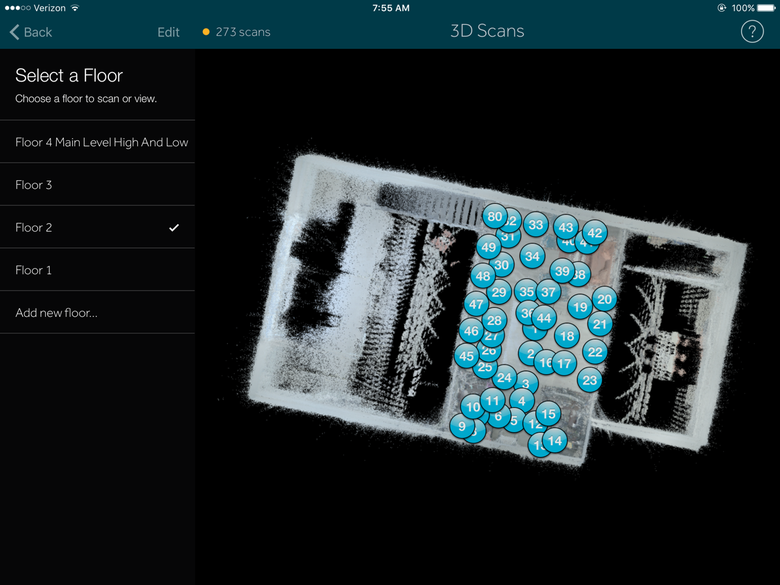 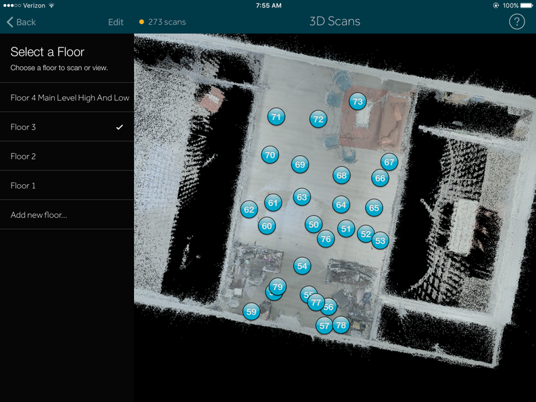 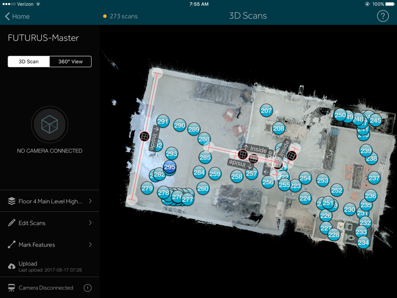 |
||
| Post 8 • IP flag post | ||
Pages:
1This topic is archived. Start new topic?


