Takeaways>Labpano Pilot One Shot EyeSpy360 Virtual Tour of Our Cruise Cabin11187
Pages:
1
 WGAN Forum WGAN ForumFounder and Advisor Atlanta, Georgia |
DanSmigrod private msg quote post Address this user | |
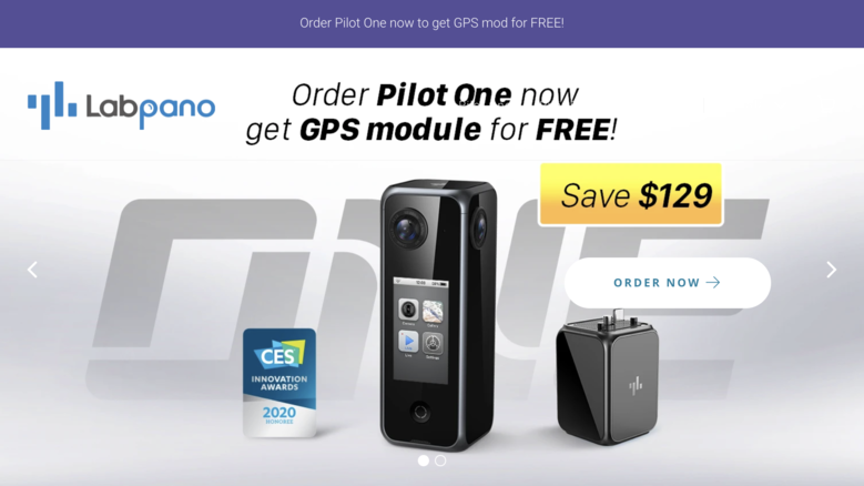
Hi All, Above is an EyeSpy360 Virtual Tour - shot with a Labpano Pilot One (Beta) 360º Camera - of our cruise cabin (suite) last week. (My wife and I were celebrating our 25th wedding anniversary with 29 Argentine tango dancing passengers on the Carnival Horizon cruise ship in the Caribbean. (We're back in Atlanta!) Here are my Labpano Pilot One takeaways: 1. My bad: I should have manually changed the focus to near (two meters). Because I did not, I got that prominent stitching error. Again, likely user error (rather than the Labpano Pilot One 360 camera. 2. All the photos are retouched (by CAPTUR3D) except the closet photo. (I forgot to submit that one. CAPTUR3D should be able to dramatically lighten up the image and remove the tripod from the mirror. I wanted to use this image so that it was used to created the dollhouse and floor plan views. (I should have manually adjusted the settings after looking at the shot. I was trying to shoot quickly because my wife was outside the stateroom waiting for me to finish.) 3. I likely did the wrong setting for the pole shot 360º over the edge of the balcony. I still have lots to learn about using the Labpano Pilot One camera 4. Many of the bad stitching errors - likely because I did not manually change the focus setting - were touched up with CAPTUR3D photo editing. I was pleasantly surprised about how much better the verticals look as a result of this retouching ($1 per image: that's all!) 5. I like that EyeSpy360 builds the tour for me; including creating the 2D floor plans and 3D dollhouse. (I will likely add hotspots with video and links.) If you would like to see the "before" images, I will put both the "before editing" and "after editing" 360º photo spheres in a Dropbox. Just post that you would like to see them. What are your takeaways looking at this EyeSpy360 Virtual Tour - shot with a Labpano Pilot One - of our Cruise Cabin. Best, Dan My wife and I enjoyed our (awesome) Carnival Horizon cruise. We were able to visit three (different) ports than originally scheduled and three hours of tango dancing daily. I'll share 360 photo images from the ship and Grand Turk in a future WGAN Forum post. ---  Screen Grab: Labpano is presently accepting Pilot One pre-orders through the first week of March ($1,199 64GB | $1,249 128GB) with a free GPS module (valued at $129) with this link. |
||
| Post 1 • IP flag post | ||
 WGAN Fan WGAN FanClub Member Queensland, Australia |
Wingman private msg quote post Address this user | |
| What is happening with Pilot Tours? I do not believe anybody has posted any example of a tour made with it. | ||
| Post 2 • IP flag post | ||
 WGAN Forum WGAN ForumFounder and Advisor Atlanta, Georgia |
DanSmigrod private msg quote post Address this user | |
Quote:Originally Posted by Wingman I tried - and failed to do a Pilot Tour successfully. I shared my experience with Labpano and they suggested that I hold off until a firmware improves the success rate of automatic tour creation. Dan |
||
| Post 3 • IP flag post | ||
 WGAN Fan WGAN FanClub Member Queensland, Australia |
Wingman private msg quote post Address this user | |
Quote:Originally Posted by DanSmigrod Thanks Dan, that explains a lot including the fact that Labpano does not want to let Pilot Era owners in Pilot Tours yet. |
||
| Post 4 • IP flag post | ||
 WGAN Forum WGAN ForumFounder and Advisor Atlanta, Georgia |
DanSmigrod private msg quote post Address this user | |
| @Wingman BTW, seems like well over a month ago that I did this preliminary test. For the WGAN Community, having another easy, fast and seamless automatic tour creation solution would be awesome. [360 image stitching and constellations (tours) done automatically.] I have high hopes that Labpano might nail this. Until Labpano gives early beta testers a green light to try again, it is too soon to know. I do anticipate receiving a Labpano Pilot One GPS module (soon) so that I can test the Pilot One for "blue line" Google Street View tour creation. Best, Dan |
||
| Post 5 • IP flag post | ||
 WGAN Fan WGAN FanClub Member Queensland, Australia |
Wingman private msg quote post Address this user | |
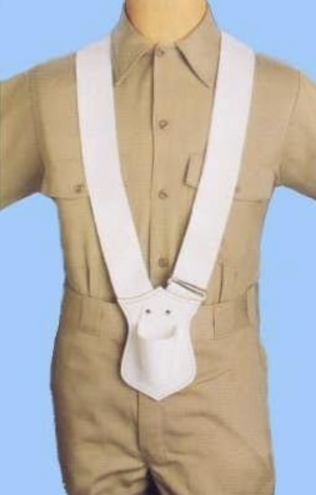
| I think Labpano is not allowing to use a smartphone GPS on purpose. Otherwise less Pilot One owners would be buying their GPS module. Since their cameras are based on Android and they have android apps for them it should not take too much time for them just to get location data from a smartphone and record it into images. However my prediction they would do it at the end for both Era and One. As no matter how good Era built in GPS or a module for One is a smartphone allows to use some 3rd party GNSS and RTK systems that can make mapping precise to 2cm(RTK) and 50-70cm(just a good GNSS receiver that can get data from 2 or more constellations). Are you planning to do a street view blue line for cars or just some pedestrian path or a trail? If you want to walk with it you can do it with an extension stick. Just make it to sit above your head with camera lenses being 30-40cm above your head. It should give you a nice view and you can completelly cover yourself at nadir with your logo. Pilot One is not as heavy as Era so it should not be a problem to keep it that way and walk. However it may be easier if you use some small pouch bag hang on your belt and put the bottom end into it. That will give you some extra support, you will feel less weight and you will only need to keep the camera up straight. BTW, two of my latest walking blue lines have been almost processed on Google and you can see them at https://goo.gl/maps/VJMAmQSt9PeQgrN88 and https://goo.gl/maps/xoLUTCTEU94aM6SF6 And Google have even created a link to join them with nearby streets. |
||
| Post 6 • IP flag post | ||
 WGAN Forum WGAN ForumFounder and Advisor Atlanta, Georgia |
DanSmigrod private msg quote post Address this user | |
 (Amazon Link) Quote: Originally Posted by Wingman Seems like the location data would be better via the GPS module than a smartphone? Quote: Originally Posted by Wingman Seems like the location data would be better via the GPS module than a smartphone where the data is converted to Latitude and longitude points via 3rd party software? Quote: Originally Posted by Wingman Initially, I will focus on adding blue lines of pedestrian paths and trails. We have some beautiful parks near where we live to do the testing. Quote: Originally Posted by Wingman Thanks for the GSV walking/shooting tip. This is all new to me. Quote: Originally Posted by Wingman Ah! Perhaps I can get a flag holder like the above? Thanks for your two GSV blue-line examples. Sweet that they joined them! Dan |
||
| Post 7 • IP flag post | ||
 WGAN Fan WGAN FanClub Member Queensland, Australia |
Wingman private msg quote post Address this user | |
| I mean something simpler than that. Have a look at this picture https://imgaz3.staticbg.com/thumb/large/upload/2014/11/12312.jpg I am sure most of us have something similar laying around or it can be bought in any $1 dollar store for $2-5. And these are just synthetic bags and they can be soft. If you have one made from thick leather that is going to be even better. As for GPS, it is good in Pilot Era for their built in but there will be always some loss in accuracy due to restrictions for its use by civilians. So I would say may be in a range of 2-5 meters. A smartphone can also be that good and slightly better if you use assisted GPS from cellular networks. And some may be even coming with better accuracy based on wireless networks around. GNSS receivers are different as they allow you to pick up what navigation system to use to get your location and some will let you pick 2 or even three constellations. When you use more than one global navigation system your accuracy improves a lot and can go below 1m. |
||
| Post 8 • IP flag post | ||
Pages:
1This topic is archived. Start new topic?


