What can 3DVista do?19534
Pages:
1
 WGAN WGANStandard Member Los Angeles |
Home3D private msg quote post Address this user | |
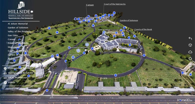
| Answer: A lot. Take a look. View this as designed, for desktop, laptop or at least iPad in landscape orientation. It opens to a 3D model so view when you have good bandwidth as well. We did a lot of work here, but to me the credit goes to the dedicated and innovative team at 3DVista that gave us the tools. HillsideTour.com  |
||
| Post 1 • IP flag post | ||
 Matterport Matterport Camera Repair Service Gainesville, Florida |
MatterFix private msg quote post Address this user | |
| Very nice! 3DVista has come a long ways over the past couple of years! | ||
| Post 2 • IP flag post | ||

|
MeshImages private msg quote post Address this user | |
| Impressive 3D Tour, congratulations! Did you scan the 3D model of the terrain yourselves? What mapping software did you use? This is great quality |
||
| Post 3 • IP flag post | ||
 WGAN WGANStandard Member Los Angeles |
Home3D private msg quote post Address this user | |
| Yes, we created the 3D model as well as everything else. Gathered about 3000 photos, drone grid approx 150' elevation, then manual flights around each of the buildings. About half the photos were shot from the ground using mirrorless Sony full-frame with 40mm lens. Particularly tricky was the canopy over the entrance of the convention center as we wanted to avoid the typical "melting" look you see on Google Earth, which uses aerial shots pretty exclusively. Images processed through Lightroom, then into Metashape for assembly. Some trial and error learning to compensate for color degradation through the 3D process and into 3DVista. Color intensity doesn't quite match the aerial panos in the tour, however the panos don't allow the incredible flexibility of exploring the 180 acres as a 3D model. Client is thrilled. |
||
| Post 4 • IP flag post | ||

|
MeshImages private msg quote post Address this user | |
| Impressive workflow, chapeau! I think you have good chances to place this tour on the 3DVista website as client sample. This would be a great marketing effect for your business. |
||
| Post 5 • IP flag post | ||
Pages:
1This topic is archived. Start new topic?


