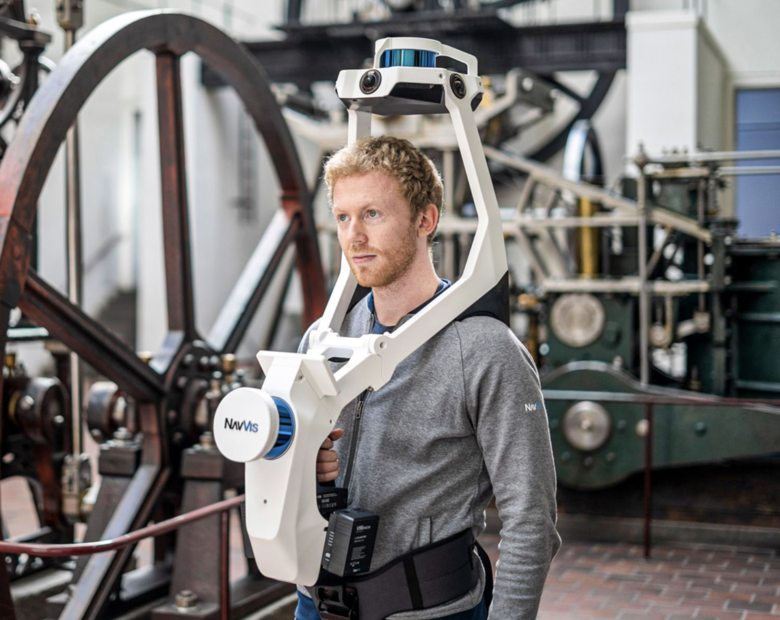
NavVis VLX wearable mapping system>Point Clouds & High-Resolution Panoramas11962
Pages:
1
 WGAN Forum WGAN ForumFounder & WGAN-TV Podcast Host Atlanta, Georgia |
DanSmigrod private msg quote post Address this user | |
 Image courtesy of NavVis NavVis (12 May 2020) New Product Announcement: Introducing NavVis VLX "NavVis VLX ... wearable mapping system designed for hands-free, all-in-one reality capture, including survey-grade point clouds, in even the most complex environments such as construction sites, staircases and technical rooms," says the NavVis blog. "The all-in-one reality capture capabilities of NavVis VLX include both survey-grade point clouds and high-resolution panoramas. NavVis VLX is equipped with two LiDAR sensors and is able to quickly and efficiently capture survey-grade point clouds using the same ground-breaking SLAM technology that NavVis has developed for its industry-leading system, NavVis M6. Along with point clouds, NavVis VLX captures high-resolution panorama images in a complete 360° field of view, which is a result of four strategically positioned cameras," says the NavVis blog. '“We designed NavVis VLX to provide the AEC industry with a compact, versatile device that efficiently captures buildings and still delivers survey-grade point clouds,” said Georg Schroth, NavVis CTO," says the NavVis blog. "The data captured by NavVis VLX can be applied to a wide-range of applications including conventional building documentation such as CAD drawings and BIM models, but also to innovative digital twin solutions, such as NavVis IndoorViewer," says the NavVis blog. Your thoughts? Dan |
||
| Post 1 • IP flag post | ||

Cincinnati, OH |
leonherbert private msg quote post Address this user | |
| @DanSmigrod I am going to have to sell my Maserati | ||
| Post 2 • IP flag post | ||

|
APN private msg quote post Address this user | |
| This looks like the concept Indoor Reality created. | ||
| Post 3 • IP flag post | ||
Pages:
1This topic is archived. Start new topic?


