How to extract geolocation data from 360 Google Street View panoramas?11363
Pages:
1|
|
DoraZ private msg quote post Address this user | |
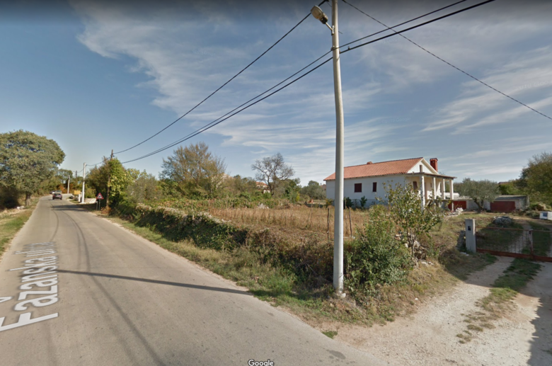
| I was wondering if anyone can help me, or has done something similar so far. Briefly, let's say I am making video for google streeet view and I go through a road. That video converts into a bunch of pictures on GSV. In some pictures there is for example a public lighting pole, and I want to know its coordinates. An example is one GSV picture (not taken by me, it is their official picture), but let's say I took it, and now I want coordinates of this pole, so when I open my 360 photos in some other program (for example QGIS),I can map this pole. Is it even possible? I hope you have some answers or can reddirect me to one of the forum topics.  |
||
| Post 1 • IP flag post | ||

Frisco, Texas |
Metroplex360 private msg quote post Address this user | |
| If you have the ability to download this, it should be in the metadata. | ||
| Post 2 • IP flag post | ||
|
|
DoraZ private msg quote post Address this user | |
| Hi! Thank you for your answer! Do you perhaps know, if I can download it, how to later colect it in a way I have a .txt document with a bunch of data, where among others, is the gps data (lat,lon)? I have been using ExifTool or similar products to see metadata, but I want to extract only important ones so I can upload it somewhere else (for example QGIS). Do you know how to do that? |
||
| Post 3 • IP flag post | ||
 WGAN Forum WGAN ForumFounder & WGAN-TV Podcast Host Atlanta, Georgia |
DanSmigrod private msg quote post Address this user | |
| @Metroplex360 Thanks! @DoraZ Quote: Originally Posted by @DoraZ I sent a note to NCTech with this question to see if you used the NCTech iStar Pulsar, would you be able to retrieve this metadata. Dan |
||
| Post 4 • IP flag post | ||
 WGAN Forum WGAN ForumFounder & WGAN-TV Podcast Host Atlanta, Georgia |
DanSmigrod private msg quote post Address this user | |
| @DoraZ I received the following reply from NCTech. Dan --- Hi Dan, Yes it's possible to identify the lat/long of an object in a set of panos from iSTAR Pulsar, but you have to use an application that lets you do this, such as Occumap. However, the accuracy is only as good as the relative positional accuracy of the GNSS system being used. Our built in GPS only offers at best around 2 - 2.5m accuracy so you could be up to around 5m off actual position. A more accurate GPS will of course reduce that margin of error. Andrew Baddeley Technical Sales Director NCTech Ltd |
||
| Post 5 • IP flag post | ||
|
|
DoraZ private msg quote post Address this user | |
| @DanSmigrod, thank you so much for that! I watched a video on Occumap and that is basiccaly the thing I was looking for! Thanks for pointing out the possible accuracy problem, I should actually see what does the third party we sell our service to says about that, is it a problem or not. Thanks you! If you find something similar like Occumap, please get back to me. |
||
| Post 6 • IP flag post | ||
 WGAN Forum WGAN ForumFounder & WGAN-TV Podcast Host Atlanta, Georgia |
DanSmigrod private msg quote post Address this user | |
| @DoraZ Can you post a link to the Occumap video that you watched? Thanks, Dan |
||
| Post 7 • IP flag post | ||
|
|
DoraZ private msg quote post Address this user | |
| @DanSmigrod here is a link of the video https://vimeo.com/290369719 Hope it works |
||
| Post 8 • IP flag post | ||
 WGAN Forum WGAN ForumFounder & WGAN-TV Podcast Host Atlanta, Georgia |
DanSmigrod private msg quote post Address this user | |
| @DoraZ Thank you! Dan |
||
| Post 9 • IP flag post | ||
Pages:
1This topic is archived. Start new topic?


