What is the learning curve for shooting GeoCV 3D Aerial?9027
Pages:
1
 WGAN Forum WGAN ForumFounder & WGAN-TV Podcast Host Atlanta, Georgia |
DanSmigrod private msg quote post Address this user | |
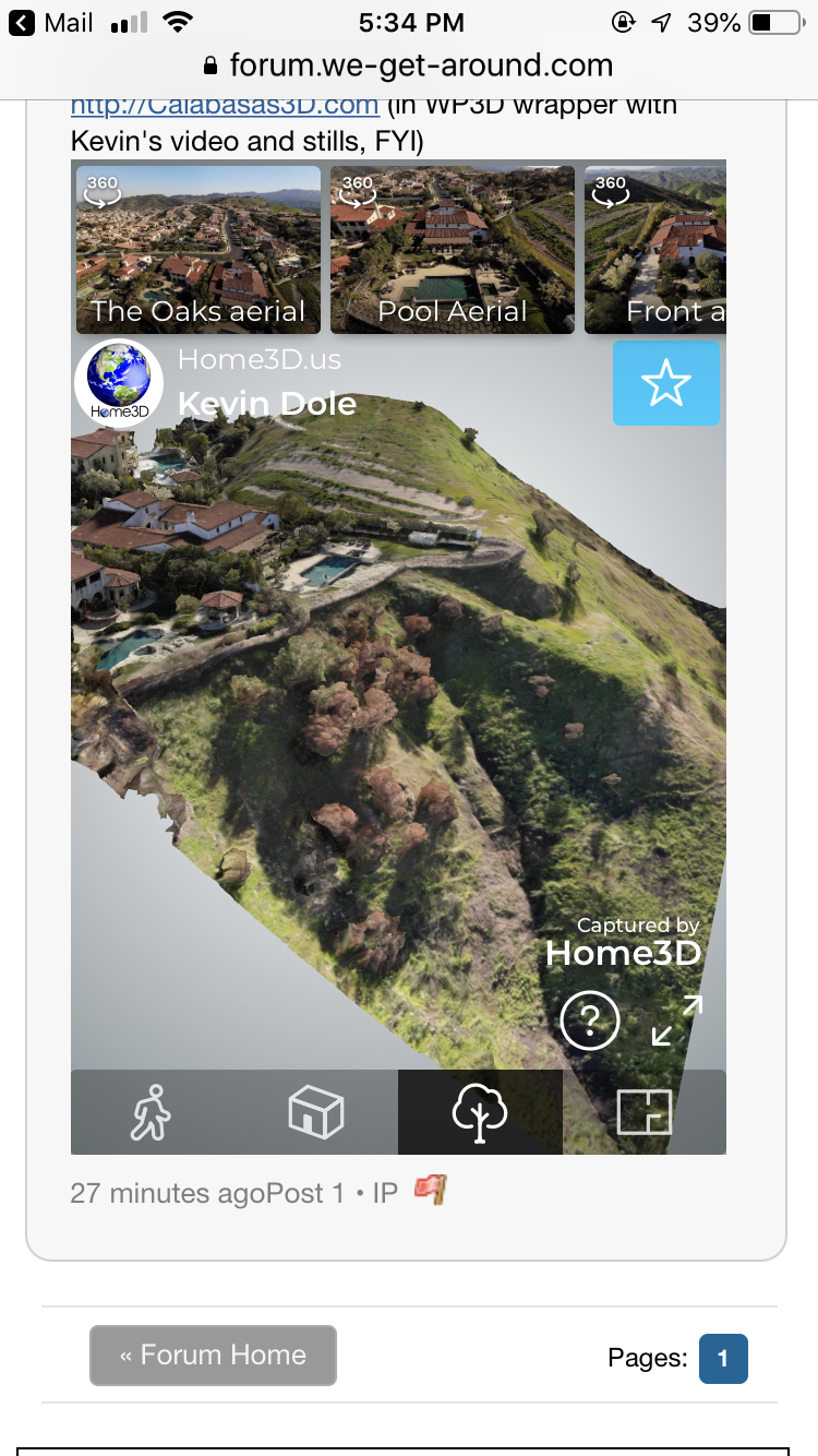
| Video: WGAN-TV Short Story #526 with Los Angeles-based Home3D.us (@Home3D) Kevin Dole Hi All, A GeoCV 3D Tour can include 3D aerial. How is that done and how whats the learning curve for GeoCV 3D aerial? In this WGAN-TV Short Story #526, Los Angeles-based Home3D.us - @Home3D - Kevin Dole describes the GeoCV learning curve for shooting, back-end and at-length about 3D aerial. You can watch the entire discussion with Kevin here. (Kevin borrowed the GeoCV Kit from the WGAN 360º Camera Loaner Program.) Best, Dan P.S. We'll add a 3D version of the aerial in the future. This is a GeoCV 3D Tour that Kevin created that includes aerial 360ºs – again, not the 3D version. GeoCV with exterior terrain - http://Calabasas3D.com (in WP3D wrapper with Kevin's video and stills, FYI) Could not convert link |
||
| Post 1 • IP flag post | ||
 WGAN WGANStandard Member Los Angeles |
Home3D private msg quote post Address this user | |
This link DOES include the 3D aerial. Just tap the “tree” icon at the bottom, as I have here. Enjoy the magic. |
||
| Post 2 • IP flag post | ||
 WGAN WGANStandard Member Chicago |
rzphotoman private msg quote post Address this user | |
| The aerial 3D work looks great, but I have to question how practical it really is. Considering the learning curve with all the trial and error involved...who has the time and how often will you actually be hired to do this. I am also assuming the processing fee will be high so that will limit how many end users there are in my market area. And after learning how to do it, if I don't have a willing client for a few months...maybe a year...I imagine there would be more trial and error involved in getting it right again. Like I said, the end result is really nice but in practical terms I don't see a big return on the time investment. IMHO |
||
| Post 3 • IP flag post | ||

|
Convrts private msg quote post Address this user | |
| This looks pretty nifty, however I'm wondering is there an aerial mapping option which will allow me to create an aerial map and then embed / link tours within it? I'm currently creating tours for all of the buildings on a University campus and am looking for a way to have the end result as an aerial map with various hot spots which could be clicked on to open the tour of that specific building. |
||
| Post 4 • IP flag post | ||
 WGAN Forum WGAN ForumFounder & WGAN-TV Podcast Host Atlanta, Georgia |
DanSmigrod private msg quote post Address this user | |
Quote:Originally Posted by @Convrts @Convrts Seems like ThreeSixty Tours is exactly the solution that you are seeking for your University campus tour. ThreeSixxty Tour courtesy of ThreeSixty Tours WGAN-TV Live at 5: ThreeSixty.Tours for Newbies: Demo and Discuss with WP3D Models Developer Ross Peterson Special Offer for WGAN Standard and Premium Members WGAN Standard and Premium Members receive the free use of ThreeSixty Tours Pro 5 White Label Plan the free use of WP3D Models WordPress Plugin the free use of WordPress powered by Ionblade | Compare WGAN Membership Plans | WGAN Membership Benefits | www.JoinStandard.com |
||
| Post 5 • IP flag post | ||

|
Convrts private msg quote post Address this user | |
| Thanks Dan, that looks fantastic and an amazing solution! I know a number of clients who will love this as a way of putting their tours together |
||
| Post 6 • IP flag post | ||
Pages:
1This topic is archived. Start new topic?


