Point Cloud data inside a Point Cloud?6141
Pages:
1

|
VRimpact private msg quote post Address this user | |
| Hi there. I was wondering if anyone is an expert in pointclouds? If i had a pointcloud file say of external land and house, captured from a drone, could we then import point cloud data of internal scan of the house created by matterport? Whats your thoughts? Is this possible? |
||
| Post 1 • IP flag post | ||
|
|
ron0987 private msg quote post Address this user | |
| Yes, this can be easily done with the right software. But I would ask a basic question on why would you want to do that, just interested in the reason why. I am always interested in different reasons to use point cloud data. Ron |
||
| Post 2 • IP flag post | ||

|
VRimpact private msg quote post Address this user | |
| Tech restricitons is the main reason. I have access to a drone, and matterport camera. Matterport works internally only, Drone gets most of outside, but i cant fly the drone inside. Im looking to make a point cloud for an area with several buildings in and we would want the inside and outside converted to one single point cloud file where we can see everything. |
||
| Post 3 • IP flag post | ||
|
|
ron0987 private msg quote post Address this user | |
| For the most accurate point cloud you would have to take a few exterior shots with Matterport so there is data on the outside of the building so the point clouds have overlapping data. You could use Autodesk Recap to merge the point clouds. If you do not have exterior data you can use a software called Cloudcompare that allows you to manually place two sets of data point together. This is less accurate because you are doing it manually. Hopefully that helps. These are just two of several software's that will do this. Ron |
||
| Post 4 • IP flag post | ||

|
Bernardhhi private msg quote post Address this user | |
| I came across this very interesting video from the folks at tourbuzz clickable text is this what you’re wanting to do? Bernie |
||
| Post 5 • IP flag post | ||

|
VRimpact private msg quote post Address this user | |
| @Bernardhhi thanks for that link. Very much along the lines of what I am trying to do - but with one slight difference. Despite that being an amazingly jawdropping video and I would love to offer that service, In this video they place a designed CAD / Sketchfab model onto it. Which in itself is cool, however im trying to find a way to drop a matterport tour in it, avoiding the need to do the whole 3D drawing. But yes, you near enough nailed what I am trying to achieve! Thanks for the share... |
||
| Post 6 • IP flag post | ||
|
|
ron0987 private msg quote post Address this user | |
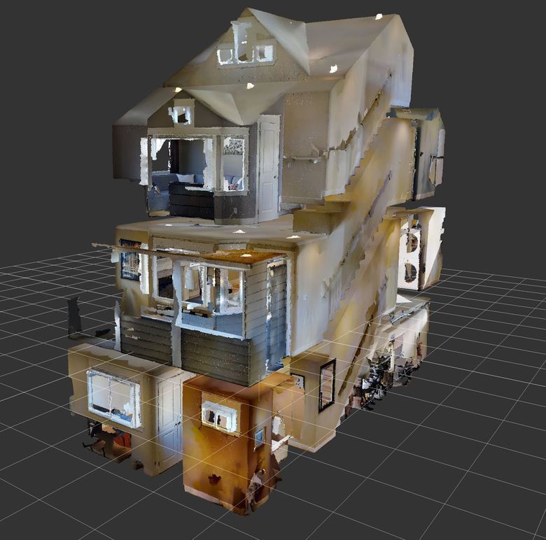
Here is a clip from a Matterport point cloud opened in Recap, so again the key point would be to have a few scans outside the house so that recap can find common point to merge the two point clouds together. so I think you could easily merge the two together.  |
||
| Post 7 • IP flag post | ||

|
VRimpact private msg quote post Address this user | |
| @ron0987 thank you for the information. Great help! I knew the answer would be out there. | ||
| Post 8 • IP flag post | ||
Pages:
1This topic is archived. Start new topic?


