Custom Satellite-based 360º Aerial Panoramas6047
Pages:
1
 WGAN Forum WGAN ForumFounder & WGAN-TV Podcast Host Atlanta, Georgia |
DanSmigrod private msg quote post Address this user | |
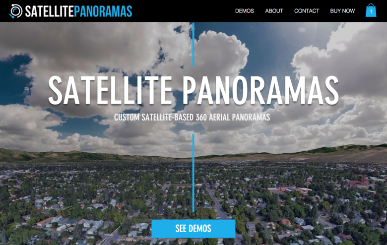
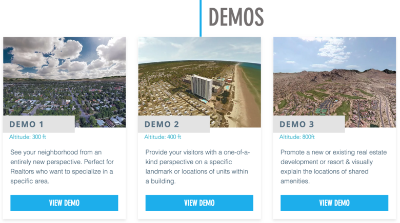
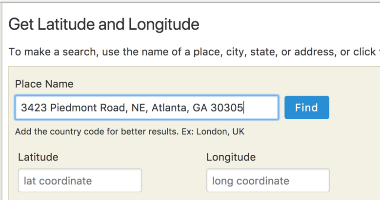
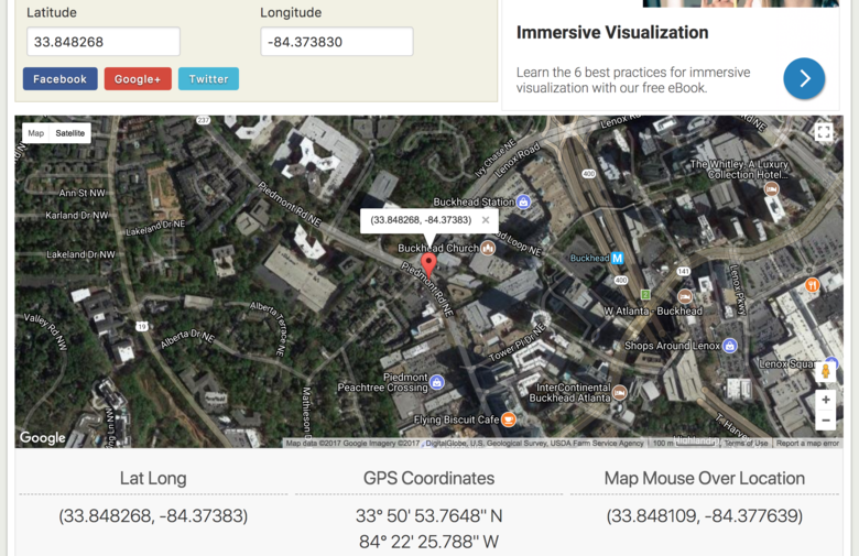
  Screen Grab courtesy of SatellitePanoramas  Screen Grab courtesy of SatellitePanoramas Hi All, To get an aerial 360º – from 100, 200, 300 or 400 feet – you don't need a drone, helicopter or airplane. And, you can get an aerial 360º even if the weather is bad; wrong season; or the area is within a no-fly zone (near an airport, military base, landmark, etc.) SatellitePanoramas is a custom Satellite-based 360º Aerial Panoramas service. To get a 360º aerial panoramas within two-business days, here's all you need to order a custom Satellite-based 360º Aerial Panorama: 1. Altitude 2. Latitude 3. Longitude Not sure what the Latitude and Longitude is? All you need is either: 1. the address - such as the We Get Around Network HQ at 3423 Piedmont Road, NE, Atlanta, GA 30305 2. place a location pin on the map ... and get back these results with the free web tool at: latlong.net.   From the SatellitePanoramas website: Email Delivery Receive your assembled equirectangular 360º panorama (6000 x 3000 JPG) via email within approximately 48 hours of order, not counting weekends & holidays. For the location you've chosen, simply enter the specific latitude, longitude and altitude. Latitude & Longitude are expected to be DECIMAL values and the altitude value will be selected from the drop down menu. Be sure to review the DEMOS for altitude examples If you don't know what to pick here, 300ft is often a good place to start for the majority of locations. Offsetting your Latitude & Longitude If you are trying to highlight a specific landmark/property location, you may want to select latitude/longitude values that are slightly offset to prevent that landmark from being seen directly at the bottom (nadir) of your generated image. Satellite Panoramas provides the service of generating your 360 panorama image with proper attribution for your own personal use! [See Zenith (top) of demo aerial 360ºs ...] All sales are final, so please be sure to verify your latitude & longitude values prior to purchase! ✓ SatellitePanoramas.com Demo 1 (Altitude 300 feet) ✓ SatellitePanoramas.com Demo 2 (Altitude 400 feet) ✓ SatellitePanoramas.com Demo 3 (Altitude 800 feet) Reminder: once you locate your address, move the map location pin to the distance that you would like to view the place. NOT directly down. For the test address above for the We Get Around Network headquarters in Atlanta, I actually used: 1. Altitude | 200 feet 2. Latitude | 33.850658 3. Longitude | -84.393282 Special Offer for We Get Around Network Basic, Standard and Premium Members ✓ $75 instead of $149 each ✓ to receive your promo code, please see your Welcome Onboard Letter (PM me for the password) Thought-Starters 1. Integrate with ThreeSixty Tours 360º hosting and sharing platform 2. Add to Single Property Websites powered by WP3D Models Wordpress Plugin 3. Up-Sell - before or after delivering a Matterport 3D Tour and/or Google Street View tour 4. Bundle (make your competition irrelevant 5. Order on spec and then offer to clients and prospects I could imagine offering satellite-based 360º aerials for $249; $349 or $499 (in no-fly zones, for example). How might you use custom satellite-based 360º aerial panoramas? Happy New Year, Dan |
||
| Post 1 • IP flag post | ||
|
|
ron0987 private msg quote post Address this user | |
| This is pretty good option, I did not see that it pinned the property or highlight it did I miss something? Ron |
||
| Post 2 • IP flag post | ||
 WGAN Forum WGAN ForumFounder & WGAN-TV Podcast Host Atlanta, Georgia |
DanSmigrod private msg quote post Address this user | |
| @ron0987 Once you have the 360º Panorama, you can annotate it within ThreeSixty Tours, for example. Happy birthday, Dan |
||
| Post 3 • IP flag post | ||
|
Belfast, United Kingdom |
3dshowcaseuk private msg quote post Address this user | |
| Can I ask are these LIVE or are they from dated Google Maps Or Google Earth? For example if a developer asked for a 360 of a building development on Thursday can it be done? Thanks |
||
| Post 4 • IP flag post | ||
 WGAN Forum WGAN ForumFounder & WGAN-TV Podcast Host Atlanta, Georgia |
DanSmigrod private msg quote post Address this user | |
| @3dshowcaseuk Dated ... The source for the Satellite 360º Panoramas are Google Earth Image Landsat / Copernicus). If you order, look at Google Earth to see when the "photo" was taken. Dan |
||
| Post 5 • IP flag post | ||
 WGAN Forum WGAN ForumFounder & WGAN-TV Podcast Host Atlanta, Georgia |
DanSmigrod private msg quote post Address this user | |
| @3dshowcaseuk Some additional info from the SatellitePanoramas website: --- IMAGERY DATE The date in which satellite imagery was captured varies depending on location. Satellite Panoramas is not able to control how recently this imagery was captured. Be sure to check Google Earth or Google Maps (satellite view) for a preview of the location you are interested in. Source: SatellitePanoramas --- Best, Dan |
||
| Post 6 • IP flag post | ||
 WGAN Forum WGAN ForumFounder & WGAN-TV Podcast Host Atlanta, Georgia |
DanSmigrod private msg quote post Address this user | |
| Hi All, Got an example to share? Enjoy your weekend, Dan |
||
| Post 7 • IP flag post | ||
 WGAN Forum WGAN ForumFounder & WGAN-TV Podcast Host Atlanta, Georgia |
DanSmigrod private msg quote post Address this user | |
| Hi All, I could imagine building a business around simply offering this service. And, you could use the SAME 360º for multiple clients Anyone else thinking similar thoughts? Best, Dan |
||
| Post 8 • IP flag post | ||

|
LeventeSolczi private msg quote post Address this user | |
| I made a 360 pano from google earth. It was so easy with ptgui and after pano2vr: the result: satellite 360 pano with hotspots and tags. If you would like: i can make a video about the process. It takes one our : so we can earn 100 usd and the 360 tours host price |
||
| Post 9 • IP flag post | ||
|
Belfast, United Kingdom |
3dshowcaseuk private msg quote post Address this user | |
| My idea wind have been to sell it to developers for new developments but as the imagery may not be up to date that puts that plan out the window. Who do you see as the clients Dan and what application. Basically who needs this and why?? |
||
| Post 10 • IP flag post | ||
|
|
ron0987 private msg quote post Address this user | |
| @LeventeSolczi can you post a sample of one you did to show. Ron |
||
| Post 11 • IP flag post | ||

|
LeventeSolczi private msg quote post Address this user | |
| Yes, but i am not at that member level who can show his site. I'm very happy to present such a job if Dan allows me to take it. |
||
| Post 12 • IP flag post | ||
 WGAN Forum WGAN ForumFounder & WGAN-TV Podcast Host Atlanta, Georgia |
DanSmigrod private msg quote post Address this user | |
Quote:Originally Posted by @LeventeSolczi Yes. Please do share a video about the process. Quote: Originally Posted by @LeventeSolczi Yes. Please share a sample of one that you did. Thanks, Dan |
||
| Post 13 • IP flag post | ||
 WGAN Forum WGAN ForumFounder & WGAN-TV Podcast Host Atlanta, Georgia |
DanSmigrod private msg quote post Address this user | |
Quote:Originally Posted by @3dshowcaseuk Yes. You would want to look at Google Earth to see if the imagery is up-to-date. Unlike in the movies, they don't move the satellite to shoot the imagery. Sometimes the satellite panorama will meet your needs; sometimes it won't. Since I am not an aerial photographer, I may have a different take on those that are. My initial thoughts: 1. For $49 for WGAN Basic, Standard and Premium Members ($99 for everyone else), it's an easy, fast and affordable solution to getting an aerial 360º to pair with ThreeSixty Tours (hosting and sharing). ThreeSixty Tours pairs nicely with WP3D Models - creating all kings of workflow possibilities. 2. Even if you are a drone photographer, you can run into restricted airspace. This might be a workaround. 3. I could imagine gifting it to selected clients - a thank you for your business. (If you would like this for future properties, its $199 each (nice margin). 4. I could imagine offering it free with bundle. 5. I could imagine offering as optional extra. 6. As you asked - Basically who needs this and why?? - that's the key question. I like to put things out there to see if others have ideas on this topic, in particular. Best, Dan |
||
| Post 14 • IP flag post | ||

|
whereareweat private msg quote post Address this user | |
Hey Dan, first post so …  , not 100% sure which thread to post this to, as there seems to be a few floating around aerial imaging. This seems the best given the originator was about SatellitePanoramas, and I think what I did was just a manual process to their solution, maybe? , not 100% sure which thread to post this to, as there seems to be a few floating around aerial imaging. This seems the best given the originator was about SatellitePanoramas, and I think what I did was just a manual process to their solution, maybe? Firstly your post was super helpful in knowing where to start on this. https://www.wegetaroundnetwork.com/topic/5596/page/1/how-to-create-aerial-360-with-google-earth/#1 So here's the example ------------ https://my.threesixty.tours/app/v/560809/2fk36f Kudos to the https://threesixty.tours/ simples, upload and you're done. (the fact you’ve made http://photo-sphere-viewer.js.org sooooo easy is awesome ------------ So as a previous member states it was pretty straight forward once you get started. And really my only existing cost was my ACC subscription, as I was using the trial of PTGui - hence the watermark on the 360 (but that is an inexpensive purchase in the whole scheme of things, and its one and done) and the free subscription to https://threesixty.tours/, mange to test in 5 attempts ------------ So Lessons learned for me, 1. Photoshop was shockingly bad trying to render spherically - so after multiple attempts I just gave up and went with PTGui, no surprise I suppose 2. The KML can be loaded directly into the browser version of google earth and was easy to navigate through the 29 images you need to create, a little time consuming, minutes not hours. I'm sure I can automate that piece. 3. Steps I took were 1. Find lat long, move the marker back though so to get a better circle of images around the location you want, trial and error 2. http://loh.fr/panokml.php - create the KML file -> I run this code locally now 3. Load into https://earth.google.com/web/ -> bookmarks -> “import KML file” - you may need to enable KML import in settings 4. Voila - 29 location points, double click on each and take a screen shot 5. PTGui import / Photoshop - camera raw; back and forth to tweak 6. Create panorama 7. Upload to https://threesixty.tours/ 4. I personally found this tutorial helpful, it walked through some of the PTGUI aspects - fyi paid subscription on Lynda.com (or through premium linked in) - "https://www.lynda.com/course-tutorials/Learning-Aerial-Photography-Drones/574708-2.html” - The Tutorial made me remember I needed to add a proper sky as google earth doesn’t give you one of those  stars, but no clouds stars, but no clouds5. My PS skills are not great so the lighting doesn’t really blend, but was quick and dirty to see if this was indeed doable quickly, but some cool tricks could be applied for very little investment (time mainly) 6. Obviously hugely constrained by google, populated areas obviously work best, again lots of trial and error playing around with the altitude. I found it fun to play around with anyway. All your points resonated to a large degree, fun times ahead... Have a good weekend. |
||
| Post 15 • IP flag post | ||
 WGAN Forum WGAN ForumFounder & WGAN-TV Podcast Host Atlanta, Georgia |
DanSmigrod private msg quote post Address this user | |
| @whereareweat Much thanks and thanks for your detailed "how to" ... Dan |
||
| Post 16 • IP flag post | ||
 WGAN Forum WGAN ForumFounder & WGAN-TV Podcast Host Atlanta, Georgia |
DanSmigrod private msg quote post Address this user | |
| How are you using Satellite Panoramas? Best, Dan |
||
| Post 17 • IP flag post | ||
Pages:
1This topic is archived. Start new topic?


