


Sun Position App556
Pages:
1

Orange, California |
craigsauer private msg quote post Address this user | |
| I just brought this up in another thread, but wanted to start a new one more specifically about this issue. I've recently started using an app the overlays the path of the sun on my phone's camera view. It's been really helpful in predicting when an outdoor area I'm hoping to scan will be in shade. The one I've been using is called Sun Position on my Android phone: https://play.google.com/store/apps/details?id=com.andymstone.sunposition&hl=en I've just been using the free Demo version and it's been great so I may upgrade to see if the full versions is even better. Craig |
||
| Post 1 • IP flag post | ||

|
gofastpro private msg quote post Address this user | |
I use http://suncalc.net overlaid on Google satellite view to plan shoot times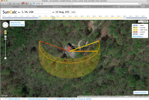 |
||
| Post 2 • IP flag post | ||

|
PlatinumTOD private msg quote post Address this user | |
| That suncalc.net link is pretty nifty @gofastpro - I am going to have to remember that one. | ||
| Post 3 • IP flag post | ||
Pages:
1This topic is archived. Start new topic?