


WGAN Podcast: Will RE Drone Photos be Replaced by NOVI Space Intelligence?20770
Pages:
1
 WGAN Forum WGAN ForumFounder & WGAN-TV Podcast Host Atlanta, Georgia |
DanSmigrod private msg quote post Address this user | |
WGAN-TV | Will Real Estate Drone Photography be Replaced by NOVI Space Intelligence?[/b] | Guest: NOVI Chief Executive Officer Michael Bartholomeusz | Thursday, 6 March 2025 | Episode: 237 www.NOVIspace.ai WGAN-TV Podcast | WGAN Forum Podcast 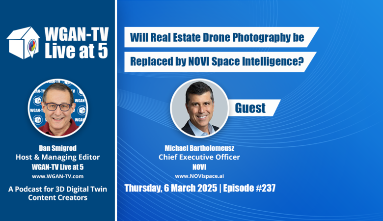 WGAN-TV Podcast | WGAN Forum Podcast WGAN-TV Podcast | Will Real Estate Drone Photography be Replaced by NOVI Space Intelligence? | Guest: NOVI Chief Executive Officer Michael Bartholomeusz | Thursday, 6 March 2025 | Episode: 237 www.NOVIspace.ai WGAN Forum Podcast | Will Real Estate Drone Photography be Replaced by NOVI Space Intelligence? | Guest: NOVI Chief Executive Officer Michael Bartholomeusz | Thursday, 6 March 2025 | Episode: 237 www.NOVIspace.ai WGAN-TV eBook | Will Real Estate Drone Photography be Replaced by NOVI Space Intelligence? | Guest: NOVI Chief Executive Officer Michael Bartholomeusz | Thursday, 6 March 2025 | Episode: 237 www.NOVIspace.ai  WGAN-TV Training U WGAN-TV Training Academy | Will Real Estate Drone Photography be Replaced by NOVI Space Intelligence? | Guest: NOVI Chief Executive Officer Michael Bartholomeusz | Thursday, 6 March 2025 | Episode: 237 www.NOVIspace.ai WGAN-TV YouTube Channel | Will Real Estate Drone Photography be Replaced by NOVI Space Intelligence? | Guest: NOVI Chief Executive Officer Michael Bartholomeusz | Thursday, 6 March 2025 | Episode: 237 www.NOVIspace.ai WGAN-TV | Will Real Estate Drone Photography be Replaced by NOVI Space Intelligence? | Guest: NOVI Chief Executive Officer Michael Bartholomeusz | Thursday, 6 March 2025 | Episode: 237 www.NOVIspace.ai Video: How Novi is Building Edge Computing Hardware for Satellites | Video courtesy of Just Rocket Science YouTube Channel | 6 January 2025 WGAN-TV Podcast | Will Real Estate Drone Photography be Replaced by NOVI Space Intelligence? Hi All, [WGAN-TV Podcast (above) ... Transcript (below)] Are you wondering: ✓ If real estate images via satellite could replace drone photos? ✓ If satellite images may solve the problem when properties are located in a no fly zone? ✓ If satellite images could be less than 24 hours old and be super-affordable? Stay tuned! On WGAN-TV Live at 5 (5 PM ET) on Thursday, 6 March 2025, our guest is: ✓ Dr. Michael Bartholomeusz, Chief Executive Officer of NOVI NOVI is a Space AI infrastructure company deploying multi-sensor edge-processing satellites for Earth Observation (EO) coupled to a full-stack data/algorithm/intelligence management platform VISTAsat™. This space AI marketplace provides open-access to its satellite network, enabling companies/governments/developers to harness real-time space-based sensors, processors and intelligence thereby driving down cost, accelerating innovation, creating new use-cases and redefining how industries leverage EO. Our topic is: ✓ Will Real Estate Drone Photography be Replaced by NOVI Space Intelligence? Dr. Bartholomeusz will share insights into how the NOVI multi-sensor edge-processing satellites and VISTAsat™ AI marketplace may affect real estate photographers and digital property marketing. What You’ll Learn Here’s what we will cover during this WGAN-TV Live at 5 show: Space-Based Real Estate Imaging ✓ How the NOVI satellite technology captures property and land data. ✓ The advantages and limitations of satellite-based property imaging. AI-Driven Earth Observation for Real Estate ✓ How the NOVI AI-powered VISTAsat™ platform processes satellite data for actionable insights. ✓ The potential of space-based intelligence for real estate photographers. Cost and Scalability ✓ How the NOVI satellite solutions compare in cost to traditional drone-based real estate imaging. ✓ The scalability of the NOVI system for residential, commercial, and large-scale development projects. New Use Cases in Real Estate and Beyond ✓ How space-based AI may help real estate professionals with land assessments, risk analysis, and property monitoring. ✓ How real estate photographers that offer drone photography may benefit from real-time satellite intelligence. Why This Matters For real estate photographers, drone pilots, and industry professionals, space-based AI presents both opportunities and challenges. This episode will explore how satellite technology: ✓ Could complement—or even replace—traditional drone-based real estate imaging. ✓ Provides real-time, AI-enhanced insights at scale. ✓ Opens new revenue streams and applications beyond marketing photography. Among the questions I’ll Ask Dr. Bartholomeusz: Technology & Innovation Q: How does the NOVI satellite technology compare to traditional drones for high-resolution property imaging? Q: What role does AI play in processing and analyzing the NOVI Earth Observation data? Use Cases for Real Estate Q: How can real estate agents and developers use satellite-based intelligence for property assessments? Market Disruption & Adoption Q: Could space-based imaging replace real estate drone photography, or will they coexist? Q: What industries outside of real estate will benefit from the NOVI satellite network? Cost & Accessibility Q: How does the NOVI pricing model compare to hiring a drone photographer for real estate listings? Q: What’s the process for real estate professionals to access the NOVI imaging and analytics? Future of Space-Based AI Q: What’s next for NOVI in advancing real estate intelligence from space? Q: How will AI and edge-processing evolve in satellite-based Earth Observation? Other questions that I should ask Dr. Bartholomeusz during this WGAN-TV Live at 5 show? Best, Dan |
||
| Post 1 • IP flag post | ||
|
WGAN Forum Founder & WGAN-TV Podcast Host Atlanta, Georgia |
DanSmigrod private msg quote post Address this user | |
| WGAN-TV | Will Real Estate Drone Photography be Replaced by NOVI Space Intelligence? | Guest: NOVI Chief Executive Officer Michael Bartholomeusz | Thursday, 6 March 2025 | Episode: 237 www.NOVIspace.ai Transcript (Video Above) - Are you wondering if real estate images via satellite could replace drone photos? - If satellite images may solve the problems when properties are located in an FAA No Fly Zone? - If satellite images could be less than 24 hours old and be super-affordable? Stay tuned. Hi all, I'm Dan Smigrod, Founder of the We Get Around Network Forum. [www.WeGetAroundNetworkForum.com] Today is Thursday, March 6th, 2025. You're watching WGAN-TV Live at 5: a podcast for digital twin creators shaping the future of real estate today. We have an awesome show for you: Will Real Estate Drone Photography be Replaced by NOVI Space Intelligence? Our subject matter expert is NOVI Chief Executive Officer Dr. Michael Bartholomeusz. Michael, thank you for being on the show. - It's a pleasure to be here, Dan, thank you very much for having me. - Before we hear about the NOVI satellite technology and satellite constellation launch schedule, let's fast forward five years from today, March 6th, 2030. I'm a real estate photographer. I need aerial images of a house for sale that is in an FAA No Fly Zone. How can NOVI help me? - So you know, I think one of the benefits of satellite imagery is it's persistent. It is persistent, it is ever watching. It's about 500 kilometers above the Earth's surface. So being able to image no fly zones, remote zones, areas which are hard to access for drones, really is a strong point of satellite imagery, Dan. - So are you able to take -- we're five years from now, is it anywhere on the entire Earth? - Yes, I think when you look at the NOVI satellites in three years from now, a constellation of 40 will be able to revisit and view any part on the Earth's surface within 24 hours. So you develop that degree of persistence, and in five years, when you have 60, 70, 80 satellites, you're actually looking at every few hours, you will be able to revisit the same spot on Earth and get dynamic intelligence. - So if I understand correctly, three years from now, the imagery would be, say, 24 hours old. - Correct. - Or at some point less than 24 hours old. And if we move five years out, it's a matter of- - It's a matter of hours. So maybe it's six hours, maybe it's every eight hours. And I think that's where technology is going. Sometimes it can be a little bit overwhelming, right? You develop a mesh of Earth observation infrastructure that can inform you regarding what's going on in the world within hours. And it's a profound game changer in our ability to view the world we live in. - So if I'm thinking of aerial imagery, can I get it from different angles? Can I get it, is it top down only? What does the imagery look like? - So typically if you're imaging from 500 kilometers above the Earth's surface, most of it is top down. Now you do get some degree of angle of incidents about 15 to 20 degrees. So you are able to pick up some degree of topography of the features you're looking at. But that is where -- that is not a strong suite of satellite imagery. That is where, say, drones will give you a far better localized 3D vantage point. But satellites can still give you a sense of the 3D architectures and features you're looking at. - So the satellite imagery may be a backup if you're talking about a no fly zone or some other reason that a drone can't fly, maybe it's weather related, perhaps some other issue, but otherwise it may be complementary to a drone photographer's aerial imagery? - Yes, you hit the nail on the head. I don't really see satellite imagery displacing drone imagery. I see it as a powerful augmenting tool, because I think when you look at the real estate market, infrastructure market in general, you're looking at dynamic change. There are a lot of insights about what is changing in the environment around you that informs localized development projects, localized valuation features and facets like that. So I think this is where drone photography and satellite photography become very, very powerful mated partners. Satellite provides a more macro purview, and drones drill into the details. - And the NOVI satellite constellations, are there other sensors in addition to imagery that's available to the photographer? - Yes, so if you look at the constellation, it has a hybridized sensor suite. So optical is what most people think, right? The regular optical cameras. And these cameras over time will go down to resolutions of 10 centimeters, which is no mean feat from up in space, but certainly not the resolution of drones, but certainly getting close there. But beyond that, Dan, we have sensors called hyperspectral images. Cameras today see the world in three colors, like our eyes, red, green, and blue. Hyperspectral cameras can see the world in 650 colors, in 1,000 spectral bands. So you get extremely -- the world looks very different from that viewpoint, and you can get, it's a data richness that provides tremendous insights in fields like mining, precision agriculture, maritime, forestry. So hyperspectral imaging is extremely powerful. And then we will have sensors like shortwave IR, thermal IR. Thermal IR, for example, is extremely important in forestry management. You can determine how fires are developing, where they're vectoring, what speed they're moving at, all using thermal IR sensors. So you really develop this broad sensor suite that addresses a whole slew of industries. - Well, let me bring you back just for a moment. We'll stay on perhaps real estate photographers that have a relationship with a farmer, right? What kind of images or data can the photographer in three years, in five years order from [www.NOVIspace.ai] via NOVI satellite constellation? - Right. So the things -- when you look at agriculture and you look at maximizing agricultural yields, the types of things that matter are in these agricultural fields. What is the uniformity of hydration? Does one part of the field have more water than the other? Well, with some of this advanced imaging, you can determine which parts of the field have more or less water, and inform and instruct the farmer to go address that, turn the sprinklers on, or the watering units in a particular area for longer periods of time. The other features are soil health, plant health, whether crops have diseases, and the fertilizer distribution. So in fact, all the things that farmers care about in terms of maximizing their crop yields, you can determine from space data, Earth observation data using hyperspectral imagery. - So I'm trying to map the sensor to the use case. So is the first one we were talking about, or forgive me, I think of imagery, you called it- - Hyperspectral? - No, the- - Or optical? - Optical. So, optical being first. On the hyper- - Spectral. - Spectral with the multi-layers of color, I think what you've described, I think of that as a heat map. Is that the right way to describe where that hydration is in that farmer's field? - You can think of it as a heat map. Different substances, different elements have different spectral responses. So this is just a way of really fine tuning it. The way to think about it is, it's like going from regular color TV to high def color TV. You can just see so much more, and that's where you can tell things like about crop health, about fertilizer distribution, hydration, and it's not just hyperspectral, but then it goes into the sort of the shortwave IR realm as well. - So is that the third and perhaps fourth sensor, IR infrared? - Well, the current commercial satellites going up that'll be delivered for launch this year will have optical, hyperspectral, near IR, and RF. And we didn't really talk about RF, but RF is a sensor where you can hear things. You're not looking for things, you can hear things. And this is important in maritime applications, if you're trying to find boats that may have turned their transponders off, and you're trying to listen to where these vehicles are. - Got it, sounds like an awesome use case, but I'm still trying to think in terms of our real estate photographers, is there something else that they go, "oh, there's an upsell, an add-on. I have a trusted relationship," so I suppose it's possible that our service providers are scanning boats, and those are interesting use cases. So I guess I should ask more there, but is it any land-based use related to buildings or farms that would matter with that RF? - Not really. I think what matters to your audience and to the real estate market is really what we do in the optical realm, whether it's regular optical, visible spectrum, or hyperspectral. - Okay. Ah, so even hyperspectral, that's a second sensor, but I can put it in that optical category. - Yes, it just, you're just going into bands of, you're going into, you're typically going into bands of light that your eyes or cameras don't pick up. You're just going into different bands and developing different resolutions. So it's even in the architectural industry, you could, for example, pick up when you look at the land around developments and you're trying to go through land assessment, you could see if the trees or the parks have diseased trees, or if they have problems with grass or coverage, or if there's overcoverage, that could have insurance implications. So hyperspectral just enriches the data that you would see with the regular camera to give you those insights. - Yeah, Michael, that's awesome. I'm going like this thinking of money for our real estate photographers because they work with developers. So it's possible to say, "oh, hey, I know you engage me to shoot the multi-family home, but I can actually help you even before you break ground so that you may know some of the challenges of the land, of the farm, of the real estate that's going to be developed." Is there anything else you could tease out of there that a multi-family home developer might have interest in this [hyperspectral] photography, [hyperspectral] imaging because it captures- - Well, I think, yeah, absolutely. So when I look at this, and when I look at real estate photography, one of the things that came to mind was how do you augment your business to develop recurring revenue streams, other revenue streams to bolt onto the core business? And again, I'm not a domain expert in your area, Dan, but one of the things that came to mind was if you were able to use satellite imagery in an affordable manner, and what's important is dynamic, right? If you were able to look at how an area was developing, you could potentially develop a subscription service with brokers or developers and provide a more fulsome perspective on the area where they're developing property. How has it developed? How has subsequent development gone on? Is there a lot of remodeling? What is happening to grasslands or parks? You can actually start to time track this and provide insights to partners within the broader ecosystem to monetize it, either from a subscription basis or on a co-marketing basis. So I think there are lots of opportunities to mesh that macro info into a business offering. - Yeah, while you're talking about recurring revenue or increment, let's say, what would you call that? [Timelapse photography] for taking a picture every day. Let's call that an, do you have a term? - Dynamic. Yes, so it's just dynamic monitoring. - Dynamic monitoring. I think in our world of real estate, I think that that provides perhaps for a developer to be able to say, "hey, would you like aerial photography shot every day over the course of the year of your construction so that you could be using it for social media to talk about day one, day six, day 12, day 15, so that you're creating some urgency and excitement about the build out of a large residential real estate space, a commercial office building." So I think there is that kind of opportunity. When we talk about either photos or this dynamic incremental imagery, I guess if we were trying to order this kind of imagery today, I would imagine that I couldn't possibly afford it, and the images would be anywhere from a week old to a year old, to just old out-of-date imagery. So maybe it's helpful to perhaps understand what the NOVI company is, and then talk perhaps about some of the problems and challenges that you're solving. Even before we jump in, did you want to talk a little bit about pricing? Pricing today versus would it actually be affordable for me to order photos and dynamically take photos over the course of time? - Yeah, so if you look at the state of today, I'll just give you some rough directional guidance on pricing. But typically if you buy satellite data today, the satellites up there today are not smart satellites. They just take an image, and they send those terabytes of data down to Earth. And that accrues a lot of cost because you're just sending gobs of data down to Earth. The problem too is they will send the data that covers a large swath, let's say 200 kilometers squared. So if you are a photographer who wants to get information, and you want to get information about a particular area, you have to buy a 200 kilometer square swath at about $2 a square kilometer. So that starts to add up. That's a lot of money just for one image. So what NOVI does by actually cropping the image in space or processing the image in space, can take that cost down by an order of magnitude. So it can dramatically -- it can take something that is $400 for a picture, and take it down to $40, $20. And so it really changes the economic equation in terms of affordability there. - So in today's dollars, if I'm a real estate photographer and I put up my drone and I sell aerial photography for $150, knowing that I might be able to buy an image for $20 is actually a game changer in terms of the pricing. - Yes, and that pricing, if you look at alternate models where you're actually -- I think one of the big wins is alternate models where you're providing not images anymore to partners in the space, but intelligence and insights, that's even less data, because the calculation is in space, and you can, if you provide the insights, now you're going to just dollars, you're going to dollars and cents in terms of providing insights. And I don't know if it would be worthwhile for me, maybe just to even just cite one or two use cases in terms of how I see this being used. Dan, would that be of interest? - Yeah, that would be terrific. Thank you, Michael. - So let's, I mean, this use case is subscription-based market intelligence for REALTORS and developers. Now, you may have a core business that is taking imagery, but really what you're doing is providing information. So it's not much of a stretch to say that you provide intelligence based on imagery or based on observation as a service. So for example, a purveyor of information could provide REALTORS with monthly satellite based market insights. And this is new construction activity, neighborhood development trends, vacant land tracking for future projects. And this could be offered sort of on a monthly real estate intelligence report that highlights hot zones for new listings. So those are the types of things you can do with this dynamic satellite data. And if you are looking at new construction activity, you don't have to send a bunch of pictures. You can just send the lat-long coordinates of where the activity is exactly like you said there, in a heat map, here are the hotspots for new construction activity, here's some vacant land, here's future projects and developments we're seeing. You can track that. And if you provide that as a subscription service, then that's just sort of the gift that keeps on giving. And if you're doing the analysis in space, you're now not spending $20, $10, you're literally, for these types of insights, you're probably spending 20 cents, 30 cents. And it becomes a very affordable value proposition. - Well, if we're still five years out or three years out talking about this, how will I place an order three years from now, five years from now? - So this is what -- there will be an app store, and so you would literally go into [the NOVI] app store and there'll be a whole bunch of different apps. And in different verticals there will be a proliferation of applications. So you could literally have apps that provide this intelligence, provide specific pieces of intelligence, and maybe you select three or four of them, just like you download an app onto your mobile phone to accomplish certain things. It will be exactly that. You go onto an app store, you get an app, you task it for the areas of interest, you get that information, and then you can bake it into your monthly or weekly reports to your ecosystem partners. But it's just like using an app store, Dan. - So it sounds like that NOVI is democratizing the ability to order, I want to say satellite imagery, but if I can go back to intelligence and data, to perhaps speak a little bit broadly, is it for the everyday person today, there's really two challenges. It's, A, it's not affordable. And I imagine you'll speak to why that's, a little bit more about why that's the case. Not affordable, and [B] either the imagery or the data is not current. - Exactly right. And I think the analogy to use is this. If this device cost us $30,000, not a lot of us would have it. And that's really the rub. If you want to have broad adoption of this powerful Earth Observation tool, the only way it happens is if you dramatically crash pricing. And crashing pricing is not reducing it by a factor of two, but by a factor of 10, by a factor of 20. That has to happen. - So let me go back to the, let's call it the NOVI app store. In a very simplistic world, I could type in 1234 Piedmont Avenue, Atlanta, Georgia, 30305, and there might be an app that is just simply give an overhead shot, give a shot at 15 degrees off kind of as angle shots. So someone will have developed an app that might be for real estate agents, real estate photographers to be able to order imagery of a specific property. And it literally, I did hear you mention longitude and latitude, but I imagine it might literally be as easy as typing in an address and someone is actually doing the conversion to lat-long in order to grab those images or the data. - Yes. So I mean, today, you can go and do a similar thing on Google Maps, but it is very old data and it's very low resolution, right? You try to get anywhere close, it goes fuzzy. So in that particular use case, absolutely. Imagine being able to go in there, putting in the address, and you get a 10 centimeter resolution picture of the particular property you're looking at, and you've got about a 15 degree tilt so you can get some semblance as to what it looks like. So yes, and that is possible today, you can get imagery like that from, let's say, the [Maxar Technologies] of the world, but it'll cost you your first born and take quite some time to get. - On the second example that you gave about, let's say data for a real estate agent about where there's a hotspot for construction or something. So literally there might be an app in the store where someone has said in Atlanta, badly said, tease out where the hotspots of construction are happening, and do that over time; once a week, and just keep -- and it may be that you don't even need the data is that, no, that's not the right way to say it. You don't need the imagery, you just need the data to be able to say there's a lot of construction going on in different parts of- Can you help me understand that through the NOVI app store as that example you were describing for data for a real estate agent? - Yeah, so you, for example, what you could do there is, if you wanted to, in a particular area, let's say, the Atlanta area, say identify hotspots for construction, and you could color gradient it, it could be red is very high, yellow is medium, green is stable. You could basically get a heat map, right? So you could just juxtapose that information on just a very standard map, an updated map of the area you're looking at, and you immediately get a heat map. And then the interesting thing is as time goes by, you can see how the different contours change. So also as you look at the development of an area, you can see in which direction the sprawl is going. So you can start to develop vector intelligence on how the development is going, where it's heating up, where it's cooling down. So yeah, those are all the types of dynamic data you can glean. - Okay, so how is NOVI taking us from satellite images today that may be old and not affordable, to completely affordable and super-timely imagery and data. - So fast and cheap. - Sorry. Thank you so much. I'm going to re-ask the question, how is NOVI going to make it fast and cheap in order to get a slew of imagery and data? - Absolutely. Do you think I could just put up a picture to explain that? Would that be acceptable? - Yeah, that's great. So, and while Michael's getting his screen ready, if you want to check out the website: www.NOVIspace.ai Michael, back to you. - Thank you. So what you can see on the left hand side is a NOVI satellite. And it's this particular satellite that is probably the size of a couple shoe boxes. So you're not talking about a VW Bug in space. You're talking about something that's very compact, very economical to manufacture and launch. So these are not uber expensive rigs. And if you look at the bottom of that satellite, you see all the different lenses, these are the lenses and the satellite, the lenses that'll image the Earth. Today, satellites simply have those lenses that image the Earth, and then they send all of that data down to Earth. So it's no different than if you had a roaming service on your cell phone, the more you use it, the more you're going to rack up that phone bill. So you want to use that as, oops, did I just lose the screen? - Oh no, I'm sorry I took you off of sharing, but if you feel like- - Oh no, that's perfect, that's perfect. - Yeah. - So if you -- the less you use roaming, the less you're going to rack up the charges. So what NOVI has done is we have taken the compute portion from Earth onto the satellite itself. And this, probably all of you have heard a lot about edge processing, where you move computer processing to where the applications are. Well, this is simply now taking that and moving the processing to space. If you're looking at the Earth, don't process on Earth, process in space. Because when you process in space, you analyze the data, and you discard 90% of it, and you're just sending bits and bytes down as opposed to terabytes and petabytes. And that simply just -- that simply scales like a roaming charge. And so if you're sending 100 times less data down to Earth, it's going to be 100 times cheaper transmission cost. So that's really how we break the back on that, Dan, it's just putting the compute up in space. It's really that simple. - So on the image you were sharing on the right side, was that literally the computer that we were looking at? - Yeah, that was the computer you were looking at. So it's a, these are the computer again is about the size of a dictionary. These are small compact devices, especially today with the state of semiconductor technology and micronization. You can pack very, very powerful computers into a small area, load them onto small satellites with very high powered imaging, and do all the compute in space. And maybe I'll use an analogy. Consider when you look at insights and intelligence, you're looking for a needle in a haystack. Even as a photographer, if you're interested in a small area, but you have to buy a big frame, it's still a needle in a haystack. So either, today's paradigm is you harvest the haystack in space and send the whole haystack down to Earth for people to filter through and get the needles. We simply analyze in space, get rid of the haystack, and just send the needles down. You do that, it's fast and it's cheap. - And so why are satellites today that are sending down images and data not doing that? - Some satellites do have onboard compute, but it's sort of a, it's a little bit of an afterthought. So they're more traditional models, and I think it's just incumbency, Dan. The big, big dominant players in the space have put up hundreds of satellites with no onboard compute. They can't send something there to all of a sudden go bolt on board compute. So they have to really wait for their next wave of launches to start putting onboard compute. But there's not a lot of companies talking about this as a model. They seem to still, incumbency still seems to have a lot of weight in this industry. And the problem is once they -- let's say, in future constellations, they start putting onboard compute, they're still burdened with a huge, huge basis of legacy cost that will mitigate some of their cost reduction capability. NOVI's a clean sheet company which is coming in there, our sole focus is to put up this constellation of smart satellites in space. And the only thing it does is compute in space and provide processed data, intelligence, and insights. - So, how many satellites do you have in space today? - So today we have a couple of Department of Defense assets. So I think it's worth mentioning that NOVI, for the past seven years, has been entirely focused on working for the Department of Defense. That's been our core bread and butter. But we have, just nine months ago, now started the process of migrating into the commercial sector. So we will go, we will have our first two commercial satellites up later this year [2025]. But for the Department of Defense, we have two assets. - And for the Department of Defense, was there a particular problem or challenge that they had that you can speak about of what you were trying to solve for them that resulted in this commercial business? - Yeah, I probably can't talk about the use case, but you can imagine that in the defense industry, time is very important to get information and transmit that information. So it's -- that is really what NOVI was working on, was if you process in space, you dramatically reduce the time of seeing something and then sending intelligence to respond to it. And it was when we were solving, working on those issues that we realized, my goodness, that just dramatically drives the cost down too because you're sending bits and bytes of intelligence versus petabytes of raw data. And that's what really sponsored our migration into the commercial sector. - So if I understand correctly, if I am perhaps the Department of Defense, I am super-interested in having current information, and having to wait for a satellite to fly over an individual spot, then send down that haystack of data, then process that haystack, then get to the intelligence that I want, then get that information out in the field to where it needs to be, is it takes a look in the present scenario, may take a long time. And so what NOVI has figured out is, well, let's just move the computer processing up to the satellite, we'll process the haystack of information there, so we're only transmitting back down to Earth the information that we actually want. - Yeah, and to the people who can respond to it. So you really reduce the chain of custody, and so instead of -- you're absolutely right, instead of collecting the haystack, sending it down, analyzing it, and then sending it to the assets that care, you just send it directly to the assets that care. The key element here though is a lot of what has been the advances made in AI and inference and software, because the software has to be smart enough to be, you have to train the software to look at all of this data and then develop the nuggets of actionable intelligence that are then sent down. So a lot of this goes -- if you really look at what NOVI does, we're an infrastructure company. We're setting a compute infrastructure up, infrastructure and space to support advanced compute and AI. - So is one of the challenges today that it's expensive to download a haystack worth of data? Is that part of solving the -- is it like you're trying to push a car through a straw to get it to Earth or something? - Yeah, it's very expensive. It's very expensive, and typically, since it's so much data, you have to wait for a base station pass. When you're just sending small amounts of information, you don't really need a base station. You can use other commerce channels like Iridium and things like that. So you can instantaneously pass information down without having to wait for a base station pass. So, but you are right. - I'm sorry, if you just go back for a moment, I don't understand: base station. - Oh the big ground stations, the brick and mortar ground stations that collect satellite data, so. - Ah, so you have to wait until, not only you've captured the imagery in space, but then wait till the satellite, it's at a point where one of those big dishes are, whatever it is, to actually receive the data. - Exactly. So, imagine if you can send data down, not a cellular network, but down something like Iridium, then you don't have to wait for a base station pass, you collect, you analyze, and then you just burp the data down. - Cool. Alright, so there was a problem that you were solving for your [DoD] defense client. And as a result of that, something, this aha moment, it sounds like this aha moment happened, and that aha moment meant that – Why don't you pick it up from there? Because I imagine you have some thoughts of exactly what happened and why that actually says, "oh, we have a commercial product here. We democratized this for the planet." Can you speak to that? - Yes, and I think a lot of that, at least my colleagues and I all have some shared experience in this, but I came of age in industries where dramatic cost down empowered a variety of technologies, from semiconductor chips, and computers and solar power. And so I think myself and the other principals at NOVI have lived in mired of industries where when you drive costs down, you just open up brand new horizons of commerce and technology and opportunity. And in the semiconductor industry, that's kind of called Moore's Law, right? Where you're constantly halving the price and doubling the performance, and everybody has a computer, or something with a chip in it. And that was really -- it was based on that experience that the founders and I have in NOVI that we just recognized the same pattern in space. It was just, it was a problem waiting to be solved, and we were able to sort of do the patent recognition thing and then decided to double down on this solution for Earth Observation data. - And so I imagine that in the commercial sector, the need for super timely data is not what's driving the purchase, because that sort of thing exists today. You can get this data, but it's very expensive. Is the key thing is that -- this Moore's Law has been applied to the pricing model, and the price of imagery and data has just collapsed? - It depends on the vertical. So you're right, for a lot of industries, let's say, in agriculture or infrastructure, it is okay to get an image every week or every few weeks to look at how things are changing. Maybe in some aspects of forestry, trees don't grow in a week or a month, or at least most of them don't. So you know, that degree of refresh is not that important. And especially in these industries, agriculture, forestry, cost matters, right? These departments don't have big budgets. If you now look at industries though, like forest fires, emergency response, timing is everything. So there, having that very rapid communication about how a forest fire is spreading, or how it is approaching neighborhoods becomes extremely valuable in directing and tasking and interdicting assets. The other area is in commodities trading. An interesting example, if you're a commodities trader, and let's say somebody wants to figure out what's going to happen to the price of Walmart stock. Imagine if they could count cars in Walmart parking lots on a persistent basis, and see whether there's more cars or less cars. And maybe that informs them together with other information on whether to hedge, how to hedge the stock. So there are areas in cases like that, timing matters, and that's called latency. So latency matters in some cases, but in almost all cases, commercially, price does matter. - So perhaps in the case of the fires in the greater Los Angeles area had NOVI -- if we were five years out, you would've solved two problems there. One is the latency of being able to get real time imagery, near real time imagery of the fires, and at a super affordable price for the public safety. I imagine even at a hefty price, it still would've been important. But now you're really talking about democratizing imagery and data where there's -- use your word, no latency. It's almost instant that you're getting real-time intelligence. - Yeah, and I think you bring up an important point there, right? The democratization aspect of this is key, because the technologies exist today to track fires and do all of that from space. But it's expensive. It's expensive, and it's the domain of a few companies who sort of have a lock on that and provide that information. But when you make it extremely inexpensive, people can develop apps, you and I will be able to go to the app store, download an app, and we'll be able to track that using our app. We don't need to wait for that data to be provided to us. And you can imagine that once you open up these space-based sensors to instead of 10 people in a room trying to figure out what the killer apps are, when you have thousands working on apps, you can just imagine what's going to happen to the marketplace of Earth Observation data. - Some of our photographers are, I mean, we're all pretty geeky because we do spatial data, we do LiDAR scanning but some are actually developers as well. You're talking about apps. Is there an opportunity for a real estate photographer that is a developer to actually develop an app, and does that process begin today? Do they need to wait three years, five years? Could they be thinking about this now? - Yeah, so we have just -- what we have done in preparation for launching our constellation, we have a simulator. It's very much like a flight simulator where you go and go into the flight simulator before you get behind the wheel of the plane. And we have a beta program where we have some -- we are going to have a small group of beta customers. We'll have some companies and we'll have some individual developers who will come there and start training on our simulator how to use this data, how to develop apps that they believe they can use and monetize. And this will be in preparation for going live in about nine months. And so we do currently are looking for beta users, and there's an application on our website for people who may want to participate in this beta program, www.NOVIspace.ai So, if I develop an app, is the app just for my use, is it for everyone's use? Can I monetize that app and make it available to others? How does that work? - It works very similar to the app stores you have on your smartphone. So we will -- if you look at our overall platform, which we call VISTAsat™, you will see that on [www.NOVIspace.ai] It's really -- there is a space on our platform for companies, there's a space for governments, there is space for companies, and then there's a marketplace. And the marketplace is exactly for the reason that you mentioned, Dan. It is for developers, if they develop an app, then they can sell that app on the NOVI marketplace to users. And it works very much like an app store does today. A developer would sign onto the platform, they're given a software development kit, they develop the app, they post the app, and then they sell and can monetize their app. - So if you're thinking about, oh well, we're not that far out, three years certainly, right? So 40 satellites within the next-- - Within 36 months, yes. - Within 36 months that someone perhaps, [www.WeGetAroundNetworkForum.com] that is a developer that is interested in use cases for photographers and for real estate agents, and perhaps even beyond that into other verticals if they want, could literally be developing an app that will run on a computer in a satellite constellation. - Correct. And these apps could be up and running as early as this time next year. So we were just, it's interesting, we were just talking to a developer today who was seeking to join our beta program who has an interest in developing an app to look at solar panels on different residential and commercial properties, and to develop almost a state of health type app, where you can, where people can understand, hey, which solar panels seem productive, how are they shaded on a dynamic basis to be able to, to track things that matter for individuals in that space. So yes, I mean we're already looking at developers coming in to develop this type of software and inference models that can be deployed next year. - So when I hear you're going to put 40 satellites into space in the next 36 months, I'm thinking, "wow, that's a lot of money." - This is -- so and I'll -- One of the ways to think about this is, if we build these satellites, that the cost of electronics and the cost of a lot of things that constitute satellites has come down very significantly. Depending on what sensor suite you use and some other other factors, these satellites are not -- can be a million dollars or under, can be under a million dollars a satellite. And it's amazing what SpaceX has done for launch. You can launch a satellite for about $125,000. So all in, you can put, we call them birds, you can put a bird up there for under a million dollars. So you figure 40 satellites is $40 million. If a company is generating money at the same time and is a -- NOVI certainly is a revenue-generating enterprise. Your total cash need is actually not significant. It's not hundreds of millions of dollars, it's a few tens of millions of dollars. And it's pretty amazing. - So I think what I'm hearing is NOVI doesn't have to go build a rocket. It can be a payload on SpaceX, and put your birds up into space. - Exactly. We don't, that's the one thing we don't handle is launch. We make the satellites, we procure launches, and then we manage missions and manage the infrastructure. But SpaceX and companies like SpaceX and Rocket Lab have done such a great job in launch, that there's yeah, that takes the kind of money that's on a different plane altogether. - So it turns out it isn't all that expensive. Million dollars sounds like a lot, but it doesn't sound like a humongous amount of money. It's not $20 million per satellite, it's not $50 million per, it's literally just a million dollars per satellite. And to get to your constellation, do you need all 36 to be in the air for your constellation to be working, or no, no, as we put them up, we can start to do- - Exactly. - Can you speak a little bit to that? - Yes. No, they start working the moment, the first -- so next year we will go from two to 10 birds, and then you're basically adding on about another 10 to 15 a year. And so we can -- we will start using them the moment they go up. What happens is as more and more go up, your revisit rates go down. So you're constantly improving, your revisit rates go down, we start incorporating different sensors, you can see and hear things in different ways. So it's a very, very evolutionary constellation, but you can use it from day one when the satellites go up. - And does, let's say it's just one satellite, is that one satellite mapping the entire world, or no, no, it's just within a one rotation. Help me out understanding that rotation. - So when we have a couple satellites up there, maybe you are coming back to the same place, you are looking at the same spot anywhere on the planet, let's say once a month. And then as you put more satellites, you drive it down within three years to once every day. And then as you put more satellites, you drive it down to once every half a day. So it's that type of a trajectory. And sorry, go ahead. - Well, I'm still a little confused. Is one satellite, is it like I was peeling an orange or an apple and I literally was able to peel the entire apple? Or no, no, it's just one slice around the apple? - The whole thing, the whole thing. - The whole apple? - Yes, the first two satellites will be looking at the whole globe. It'll be entirely persistent. - Wow, today is Thursday, March 6th, 2025. When are your first two satellites, your first two birds, flying? - So we've already procured two launches. They will be delivered for launch at the end of this year. And the current launch schedule is, one I believe goes up in January [2026], and the other goes up at the end of February. So by March of next year [2026], we should have these first two birds in the air. And then we've got subsequent launches to proliferate to 10 by the end of next year [2027], and then on. - And forgive me, I missed how current the data is with two two birds. - So that's about, it's about a once a month revisit rate. So that'll be for, that'll be about a once a month revisit rate, that'll cover a certain segment of applications, applications where things aren't changing on a daily or weekly basis. It gives you that degree of persistence, but that's just two birds at the beginning of the year [2026] and then you're going to 10, to 20, to 30. So we drive that down pretty fast. - So they immediately start working. It's just a question of the use case, is once a month sufficient for the particular use case? Great. If not, it just may be until there are enough birds in the sky in order to accomplish that. And it sounds like you have really two phases you're looking at: One is the 40 satellites within 36 months in order to have intelligence data/imagery that refreshes daily. - Correct. - And then the timeframe, is it five years out in order to be able to have hourly? - Yeah, so the way to look at that is after the 36 months when we hit that critical mass of 40, the current plan is every year after that to put up somewhere between 30 to 40 satellites. So what we did in 36 months, you're then going to replicate every year. And that's what takes it from 24 hours, to 18 hours, to 12 hours to six hours. And just crams it down. - When I hear you talk about this, Michael, the words that come to mine are disruptive, democratization. I mean, this seems like it changes what the possibilities are in so many different ways in so many different industries. Could you speak to this vision of what you think is going to happen within three or five years of how this disrupts, I think in a good way, various industries. - Yeah, I think it's interesting because this is something that I reflect on. I think there's, it's like with anything, right? There's sort of the good, the bad and the ugly. I think the main thing that it disrupts is it really makes our world a very, very small place. When you democratize Earth Observation data, most people will be able to go on a very user friendly tool like a mobile phone or a laptop, and will be able to look at what's going on anywhere in the world, use a whole bunch of applications to look at the world in ways they want to look at the world, whether it's an individual user, whether it's an enterprise. So I think it really brings sort of this common wealth of understanding and computational and brain power around the world we live in. It just takes it to a next level. And I can't even really fathom what some of the implications are. I certainly know that in things like farming, and agriculture, and mining, and environmental monitoring, these types of things will be greatly improved. But when you put the power into your and my hands, and thousands of people who can start looking at the world, communicating it, developing apps, I actually don't quite know where this is going to go, Dan. The only analogy I can think of, again, is a mobile phone, right? Who knew what would happen, when I was still punching on a Blackberry before the iPhone. I mean, I couldn't have contemplated all the apps we have today that were unleashed by the iPhone and then and followers. So it's going to be a similar revolution, for want of a better word. But I think the flip side of that is, my God, it's pretty intrusive too, right? You are going to be able to look at everything anywhere and everywhere in a myriad of ways. So I don't quite understand the implications of that either. You know, once you let the genie out of the box, there's going to be a lot of good that comes of it, but we're going to give up some stuff for it too. - So you're literally a rocket scientist. You've been involved with NASA going back some time. Do you have any sense of the, what's in my hand of how much the computing power would've cost, perhaps at the early days of your career or how much of a room this filled? - I think there is more computing power on this phone than there was on the Saturn project that first took Neil Armstrong into space. ... That is staggering and mind boggling to me, that you have more computing power in our hands for $500 than was on that whole first man mission to the moon. So yeah, that's sort of, that's really, and things are just that same progression of capability continues to progress. So that's one of the reasons NOVI's platform is ever evolving, constantly integrating the latest processes, latest image sensors. And so the goal is to keep this very low cost, nimble, highly agile platform that's constantly going to improve the way we look at the world and drive the cost value proposition down. - So if we fast forward three to five years from today, what you're talking about is disruptive in terms of price of driving down the cost, democratizing because the cost is so little, and enabling imagery and data, essentially intelligence that is prohibitive for the average person today, and will be completely affordable to anyone, anywhere at any time to be able to place an order. And as that app store develops, it sounds like it's that perhaps one of the most interesting things is the apps that will get developed that you haven't even imagined as perhaps, I don't know if it's millions of apps have been developed, but certainly the number of apps, and it just seems like incredible. How does artificial intelligence, machine learning fit into this conversation? - So I think that's a key element, because a lot of the apps today, I mean, artificial intelligence is a very, very broad tent, right? There's applied AI, there's general AI, there's a whole machine learning. But fundamentally, what AI helps, what advanced software helps is to look at masses of data and then pick out those needles in the haystack, pick out the needles. And as these inference models become more and more powerful, you can apply them to a far greater host of use cases that may be that in the past were almost intractable to churn through and try to get data. You know, with the way AI is developing and how user-friendly some of these modules are becoming, you're really opening this up to a broader developer community who can use AI in applications to do things and yield results that five, 10 years ago were not possible. So this is why AI infrastructure and space is so critical for Earth Observation applications because that's where it belongs. - Is the, can the apps be updated from the ground or no, once yes. So it's completely dynamic, the ability to update. So you might be able to say, using machine learning to a large data set, to say, let's train it on cars, or you're talking about the Walmart parking lot. So this is what cars look like, this is what a Walmart looks like, or maybe we actually know the longitude latitude of a Walmart store, maybe we can actually geo-fence that Walmart. This is what cars look like, and now go count those. So machine learning is defining what it is that's being counted or looked for. That may be an overly simplistic example, but then to say, "oh, well we can use artificial intelligence to then," -- how might AI be used in that particular example? - Yeah, so what AI is used for is to train the models. So you'll train the models on Earth with existing data archives. So for example, you want to do wetland detection. Well for wetlands, you'll do the training on Earth with historical archive data. And once you've trained the model, then you just upload the model. And anytime the model needs an update, you just update it. So you do the training on Earth where you're dealing with large amounts of incongruous data, but once the model is trained, you just upload it and then the model is functioning. If you actually go on our [www.NOVIspace.ai], you will see some initial apps on our marketplace. Some of the apps are live and some are coming. So you've got ship counting, wetlands detection, pool detection, right? If you're a pool company and you want to understand, you want to get a heat map of where developers are putting more pools in, so you can go and do dedicated targeted marketing, you've got pool detection apps. So that's already on our website and you'll be able to see that. - That's awesome. www.NOVIspace.ai Michael, before we say bye, maybe we've been talking for about an hour now, there's a lot to think about. Is there a way to perhaps summarize what NOVI does? - Yes. NOVI is setting up Earth Observation and compute infrastructure in space. It will be open to professionals and individuals in a broad array of industries who want to upload applications for Earth Observation, and then generate insights or generate data that they can either use for themselves or they can monetize in a marketplace, or within the confines of an enterprise. But that's really what NOVI is doing. We're offering enterprise and individuals the ability to access a sensor suite in space, and then to exploit the resulting data and information that is gathered. - Michael, thanks for being on the show. - It was my pleasure, Dan. Thank you for having me. - We've been visiting with NOVI Chief Executive Officer, Dr. Michael Bartholomeusz. For Michael, I'm Dan Smigrod, Founder of the We Get Around Network Forum, and you've been watching WGAN-TV Live at 5. |
||
| Post 2 • IP flag post | ||
Pages:
1