


More sweeping scanners Eagle/Eagle Max20590
|
|
ron0987 private msg quote post Address this user | |
| @Meidansha unfortunately it looks like they admitted to the Matterport mishap on Facebook, not sure it’s a very convoluted posting and only one from company at the time I read it. Plus dispute on tech data. Not sure what to think about it at this point. I wish they would come forward with good data, I am trying to follow that Facebook post it’s all over the place. Does anyone have any other good info? | ||
| Post 26 • IP flag post | ||
 WGAN Fan WGAN FanClub Member Queensland, Australia |
Wingman private msg quote post Address this user | |
Quote:Originally Posted by Meidansha I do not know much about L1 or L2. The way I was using mine was: After I could not use my RTK set due to how internet connections work now I simply created an account for government online services supplying corrections, got a url from them and used NTRIP android app to connect to the rover using my login details from the government service to apply correction in real time. I could get 2cm accuracy shown in the app but I had never tested with a real place or data and was just driving around with it working. Without corrections the app showed accuracy from 0.3m to 3m. Back to Eagle: There is extra information in one thread about how you can use their so called RTK module. Here is a link to the whole thread. What I see are two options: 1) post processing all GNNS data. I have forgotten what it is called but it is a valid and known method. Basically you collect all data from a rover module(their RTK system) while some stationary base near by collecting GNSS data for corrections. So you mix them together to correct rover position after it is all done https://www.facebook.com/groups/920361733495397/posts/958530949678475/ 2) There is a NTRIP Client app for Android. See the link from the developer website below but you can also find it on Google Play market. That is the app I used and mentioned at the beginning of my post. http://lefebure.com/software/ntripclient/ I am sorry for posting that link to "3D tours" done with Eagle which was not the case at all. To their defence it was not posted by 3DMakerPro in their group, it was just a member. I assumed the first tour has been done with the Eagle scanner because their pages mentioned this scanner everywhere. For me the fact that the tour was done with Matterport pro2 still does not put me in any form of regret buying it. I was asking how it can even build a 360 considering sensors position and operator visible at the back. So I did not believe it could before I purchased it. For me 3D part is the more interesting because it can capture big places for point cloud fast. I am happy with its claimed accuracy because I did not expect it could be used for AEC anyway. |
||
| Post 27 • IP flag post | ||
 WGAN WGANStandard Member Osaka, Japan |
Meidansha private msg quote post Address this user | |
| @Ron0987, Thanks for the update. @Wingman, Thanks for the details on using RTK modules. This is invaulable info for me. I haven't used RTK yet but I am just getting into mapping (at a hobby level) and I thought this would be a good opportunity to try as the module is discounted. I have considered getting a station and module for my Mavic Pro 2 and doing a home conversion but the cost of the station would set me back quite a lot for something that is not going to provide any income for the forseeable future. The Android app or government network option sounds like something worth exploring in early testing. I think I will probably use this device in combination with another 360 camera or even make DSLR 360s to improve the photo element. For small to medium sized scans this could be a good alternative to buying the Matterpak. Anyway, all will be revealed when the device arrives around April. |
||
| Post 28 • IP flag post | ||
|
WGAN Fan Club Member Queensland, Australia |
Wingman private msg quote post Address this user | |
Quote:Originally Posted by Meidansha I am going to update my memory on it so I am more than happy to help everybody. Meanwhile you can try to find NTRIP Broadcasting service in Japan that you can use for correction. I do not remember what is a limit how far away it can be from a place where your rover is. I think mine was 50-70km away and it still worked while normally they would say you will need to be no further than 25km. If anybody needs to know one in Australia I have been using and still have login details to ones run through the following government website. I sent them a request asking for access and almost straight away got a login, a password and a URL with a port number from them. Then it was only a matter entering it in the NTRIP app. The rover I used was connected to the same smartphone through Bluetooth. https://gnss.ga.gov.au/stream |
||
| Post 29 • IP flag post | ||
|
WGAN Fan Club Member Queensland, Australia |
Wingman private msg quote post Address this user | |
| I have started looking how to use Lefebure NTRIP Client app for android in case there is no Bluetooth that can be used to connect Eagle RTK rover to a smartphone running this app. So far I could not get clear instructions on how wi-fi can be used. However when I asked ChatGPT it seems to pick it up from some data found online. Anyway here are the instructions: Quote: Originally Posted by ChatGpt Please note that the link that I have given to Lefebure NTRIP Client is for their windows app. Lefebure NTRIP Client app for Android can be found on Google Play Market. At least there is a way to make it all work with this Eagle scanner RTK module. Do not forget that the phone should be connected to a mobile internet to access NTRIP Broadcaster data for correction. And the scanner can connect to the same phone through Mobile hotspot. |
||
| Post 30 • IP flag post | ||
|
WGAN Fan Club Member Queensland, Australia |
Wingman private msg quote post Address this user | |
| I got a message from them yesterday that my order is about to be shipped. It is DHL express so I hope to get it next week. | ||
| Post 31 • IP flag post | ||
|
WGAN Fan Club Member Queensland, Australia |
Wingman private msg quote post Address this user | |
| My personal Facebook account has been suspended by Facebook because somebody has created a fake account on Instagram and broke some rules. Go figure out why they suspend my Facebook account if it happened on Instagram and why I am punished for their crappy security. I googled and it apparently happens to a lot of their users for years. They tell me I can appeal but no links or any help how to do it. And honestly I do not want to do anything with this awful platform anymore. I thought they only good for stealing advertisement budget but it seems not enough for them. I will try to provide more info here on the scanner but their Facebook group was the best source. 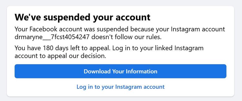 |
||
| Post 32 • IP flag post | ||
|
WGAN Fan Club Member Queensland, Australia |
Wingman private msg quote post Address this user | |
| That's not the first I have scanned with my Eagle Max scanner but it is an interesting place so lets start with it. All details are in the video description. I have another video redy for a monument near me so I will upload it to youtube and post here |
||
| Post 33 • IP flag post | ||
|
WGAN Fan Club Member Queensland, Australia |
Wingman private msg quote post Address this user | |
| This was actually the first full scan done within 2 days after we received the scanner. |
||
| Post 34 • IP flag post | ||
|
WGAN Fan Club Member Queensland, Australia |
Wingman private msg quote post Address this user | |
| And the last one for today I honestly do not know what it is called there but it is from the same place called Goodna Temple as the first video posted here. I still have another scan from there but for much smaller are/structure. I will share it later. |
||
| Post 35 • IP flag post | ||