Tips for scanning a 20000+ sq ft empty warehouse11072
Pages:
1|
Belfast, United Kingdom |
3dshowcaseuk private msg quote post Address this user | |
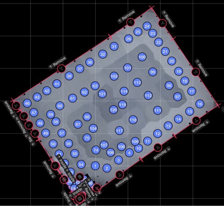
| Hi Folks Last week I scanned the biggest open space to date and I was very nervous about alignment as I have had issues before. I printed off the april tags from matterport site for assisted alignment before i went onsite, unfortunately it was only when I arrived onsite I noticed that only 27 had printed and not 50. Anyway I started off well and following advice on matterport website, I turned off fast scanning. I scanned the perimeter of the room and when I ran into issues I used the april tags as instructed. These worked well when they were stuck to the wall but not when laid on the floor. Anyway when I eventually got to the centre of the space No matter what I tried I could not get any alignment or it misaligned and put the scan in the wrong place. Then I remembered about Cortex and the conversion of 360 to 3D data. So as you can see in the video. I took a 360 image then I place on the map where it should be located and converted the data to 3D. I had to do this for approximately 15 scans(see image ) and after processing the tour turned out as perfect as it could be the only flaw being some black circles in doll house view where i had done 360 instead of normal scanning Please excuse the language in the video but I was happy to say the least as I had travelled a long distance to scan the property see video of completed tour  |
||
| Post 1 • IP flag post | ||

|
marcoastan private msg quote post Address this user | |
| So you use april tag for the perimeter, and after that when you scan from the centre, you take 360 and than convert to 3D. Am I right? | ||
| Post 2 • IP flag post | ||
|
Belfast, United Kingdom |
3dshowcaseuk private msg quote post Address this user | |
| Yes marcoastan. Scan the perimeter and keep scanning until the alignment is failing then use 360 to fill in the middle space |
||
| Post 3 • IP flag post | ||
Pages:
1This topic is archived. Start new topic?


