


Transcript-Features/Benefits of Metareal Stage V2 for Creating Digital Twin19768
Pages:
1
 WGAN Forum WGAN ForumFounder & WGAN-TV Podcast Host Atlanta, Georgia |
DanSmigrod private msg quote post Address this user | |
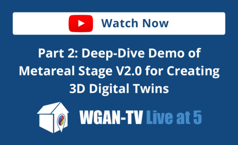
| Metareal Inc. is a WGAN Marketing Partner --- WGAN-TV | Part 1: Features and Benefits of Metareal Stage V2.0 for Creating 3D Digital Twins | Guest: Metareal Inc. Co-Founder and CEO Gareth Morgan | Episode: 214 | Thursday, 25 April 2024 | www.Metrareal.com 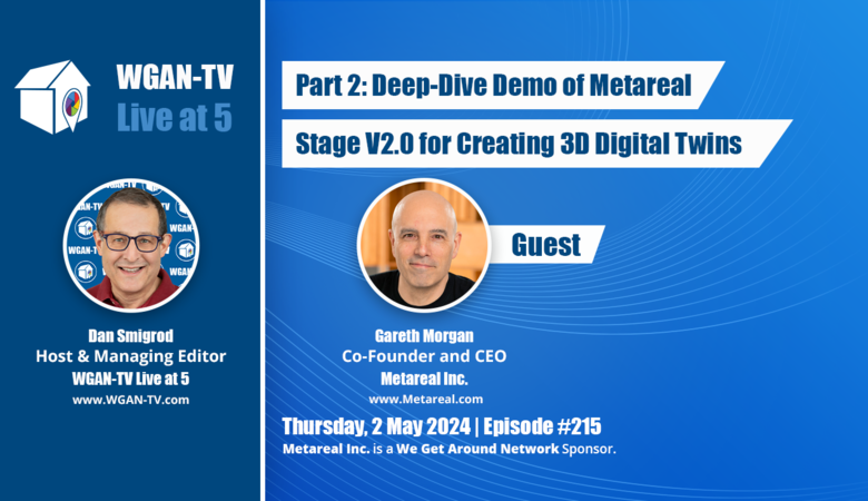 WGAN-TV | Part 2: WGAN-TV Part 2 | Deep-Dive Demo of Metareal Stage V2.0 for Creating 3D Digital Twins | Guest: Metareal Inc. Co-Founder and CEO Gareth Morgan | Episode: 215 | Thursday, 2 May 2024 | www.Metrareal.com Video: Metareal Stage Player V2.0 | Video courtesy of Metareal YouTube Channel | 16 December 2022 (Credit: Metareal Stage 3D Digital Twin by WeChalet/Le Vertendre) 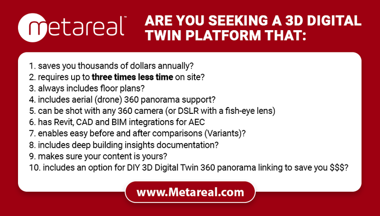 www.Metrareal.com Transcript: WGAN-TV Part 1 | Features and Benefits of Metareal Stage V2.0 for Creating 3D Digital Twins Hi All, [Transcript (below) ...] Are you seeking a 3D Digital Twin platform that: 1. saves you thousands of dollars annually? 2. requires up to three times less time on site? 3. always includes floor plans? 4. includes aerial (drone) 360 panorama support? 5. can be shot with any 360 camera (or DSLR with a fish-eye lens) 6. has Revit, CAD and BIM integrations for AEC 7. enables easy before and after comparisons (Variants)? 8. includes deep building insights documentation? 9. your content is yours? 10. includes an option for DIY 3D Digital Twin 360 panorama linking to save you $$$? Stay tuned ... On WGAN-TV Live at 5 (5 pm ET) on Thursday, 25 April 2024, my guest Metareal Inc. Co-Founder and CEO Gareth Morgan. WGAN-TV Topic: Features and Benefits of Metareal Stage V2.0 for Creating 3D Digital Twins Gareth will show and tell the features and benefits of Metareal Stage 3D Digital Twin platform. Gareth will also include a demo of the front-end: what the user sees. What questions should I ask Gareth during the show? Best, Dan P.S. In Part 2 ... -- Are you wondering how easy is the back-end of Metareal Stage V2.0? -- Would you like to see a back-end demo of Metareal Stage V2.0 by it's Co-Founder? Stay tuned ... On WGAN-TV Live at 5 (5 pm ET) on Thursday, 2 May 2024, my guest Metareal Inc. Co-Founder and CEO Gareth Morgan. WGAN-TV Part 2 | Deep-Dive Demo of Metareal Stage V2.0 for Creating 3D Digital Twins Gareth will show and tell us about the back-end of Metareal Stage V2.0. |
||
| Post 1 • IP flag post | ||
|
WGAN Forum Founder & WGAN-TV Podcast Host Atlanta, Georgia |
DanSmigrod private msg quote post Address this user | |
| WGAN-TV | Part 1: Features and Benefits of Metareal Stage V2.0 for Creating 3D Digital Twins | Guest: Metareal Inc. Co-Founder and CEO Gareth Morgan | Episode: 214 | Thursday, 25 April 2024 | www.Metrareal.com Transcript (video above) - Are you seeking a 3D digital twin platform that can: - save you thousands of dollars annually? - take up to three times less time on site? - can include aerial 360 panoramas? - your content is yours? Stay tuned. Hi, all. I'm Dan Smigrod, Founder of the [www.WeGetAroundNetwork.com]. Today is Thursday, April 25th, 2024. You're watching WGAN-TV Live at 5: a podcast for digital twin creators shaping the future of real estate today. We have an awesome show for you. Part 1: Features and Benefits of Metareal Stage V2.0 for Creating 3D Digital Twins. Our subject matter expert is [www.Metareal.com] Co-Founder and CEO, Gareth Morgan. Gareth, thanks for being my guest on the show. - Thanks. Thank you for having me on. It's great to be here. - Gareth, before we dive into today's topic, for backstory, tell us about Metareal, the company. - So, sure. We've been around since 2015, August 2015. We released our first commercial version of the platform. I think it was, we went beta 2017, so it was kind of 2018, 2019 when it started to gather some momentum commercially. We got into it, because we saw an opportunity for a 360-based 3D virtual tour platform that avoided some of the complexities and data and pitfalls of the scanning technology that was around at the time. These days, we're a global SaaS. We're in, I think, 80 something countries globally at this point. We have about 40,000 users total. About 10,000 live tours on the site, which is, I think, about 25 terabytes of data or something like that, starting to be a pretty significant chunk. And that's pretty much where we're at really. We're still very much a scrappy startup and I hope we'll stay that way. - Awesome. Part 1: Features and Benefits of Metareal Stage V2.0 for Creating 3D Digital Twins. Tell us about the features and benefits. - So, what we've got is this release, obviously the platform's matured over the last couple of years and now we've got what we feel is a really well-fleshed out platform that offers a good range of functionality for folks on the real estate side. We have customers in architectural visualization, engineering, construction, real estate, obviously, property management, also retail, hospitality, heritage, and the sort of straight virtual tour service providers. So, quite a broad range of customers there. And that reflects, I think, the feature set, which is also pretty -- got a good range of features for a wide range of use cases. - So, do you want to show us some examples of tours and show us perhaps the front-end features of the tours and why that's important? - Sure. Let's get right into that. So, one of the things that actually, I'll tee up right now is one of the things that's quite- - So, while Gareth is getting his screen share ready, you can visit: www.Metareal.com and you can actually get started for free. Your first tour is free with Metareal. - Yeah, and to that point exactly, I'll just quickly show folks the pricing plans. So, we got both monthly annual pricing. When you sign up, you're billed your own local currency. So, we give a ballpark exchange valuation here. - Gareth, could I trouble you to set that to the USA Annual? - Sure, I can. - [Dan] Easier for our audience. - Absolutely. That's a great point. There you go. So, we've got the Creator Plan. Obviously that doesn't show up on an annual because it's free. And basically, with these plans, you get unlimited amount of storage. That means you can have an unlimited number of projects in your account. With the free plan, you just get one live virtual tour that you can actually publish and share with folks. Looking at the annual, we have the Professional Plan, which basically runs from 5 to 50 live tours. We have the Premium Plan that runs from 40 to 300. And then, for folks who are going 200 or above, and have fairly high volume in terms of throughput, they can come talk to us about an Enterprise Plan. Once we get to enterprise level, we offer a more detailed quality of service commitment in terms of the contract. And there's a few other things that come along. For example, a dedicated Slack channel. We get into custom operating procedures, so that if folks have -- in terms of the full service processing -- if folks have specific requirements for floor plan styling or branding in the tours, we can add that and bundle that into the plan. - Okay. And before we move off of this page, just perhaps to point out under the Premium Plan for $224 per year for up to 40 live tours, I think many in our audience would go "wow, that is not a lot of money. What am I missing?" And I think the key piece probably here is that's a build-it-yourself tour and I think you'll explain that. And then, down at the bottom on your pricing page, it explains that if you'd like to have the tour built-out by your team, it's a little less than USD 1.75 per panorama to do that. Did I point that out okay? - That's pretty much right. Yeah, exactly. I'm just going to- - So, I imagine that's actually one of these features/benefits is if cost is your concern and you want to drive costs down, so that it is as little as possible, then you can build the tour yourself rather than having it built for you. - Yeah, and this is where our pricing model diverges a bit from some of the other platforms, such as Matterport, which is that we split out the processing costs separately from the access to the tools, which what that basically means is that when you're looking at this price here, this is for the access to the platform and the hosting. On top of that, you've got the fees for processing. So, instead of paying for all the processing you might be going to do in a year upfront, you can pay as you go and just pay for what you actually use. And I'll just pop in here. Got slides to show you, guys. So, yeah, in terms of the workflow, the sort of tour creation workflow, so if we're talking about do-it-yourself, the way things work is you upload the panoramas, you're going to then do the reconstruction of the rooms and we'll get into that in detail [www.WGAN.info/MetarealonWGAN] And then, you assemble the tour together. You've got some design customization that you can do in terms of branding, icons, and all the sort of presentation level work of the tour. And then, you can go ahead and share it. So, if you're working do-it-yourself, that's the kind of way it works. If you're working with the full service and you're sending the processing to us, basically you just upload the panoramas, ship the job, the project, to us. You've got a 24 or a 48-hour turnaround option, and then you share it with your clients. All right, so one of the other things that's worth noting is that you can publish to anywhere in the world. So, we have I think 12 data centers in different regions around the world. And I'm just going to pop into the UI briefly here just to show you what that could look like. So, here, if I go to the publishing tool, this is, we're looking at the actual editors for Metareal. You can see here, when we go to a publish a tour, we have a bunch of options to choose where we're going to publish to. So, depending on where my customer base is, I can choose to publish to different regions. And this makes it very efficient and very affordable in terms of hosting, because you haven't got to pay for hosting everywhere globally. You're just hosting where you want the tour to be consumed. - Okay, great. You want to dive in and show us some example tours? - Yeah, so one of the things that's cool about Metareal is the ability to integrate -- So, here, I've got a tour that was done for I believe, one of the local municipalities here. And one of the cool things about the tours is being able to integrate this. I'm going to show two things here. First one is the ability to integrate interactive elements like video and audio. So, here we've got a label, what we call labels added to this point in the tour. And if I click on it, we're linking to a YouTube video, which we can then control directly in the tour. Now, obviously, we've got options for size and this kind of thing, but essentially, what you can do with labels is integrate any HTML interactive development directly in the tour. So, we have folks using it for interfaces. We have customers on the property management side using this kind of interface to connect to a database backend and present information about maintenance schedules and that kind of thing. So, that's one of the pretty cool features. One of the other things you can do is integrate drone imagery. So, here, we've got some little icons that have been added into the sky in this panorama. And if I click on it, we zoom up to a drone shot of that point of view. And I can zoom back into my panorama of my tour, just like that. Well, cool transition. So, this is something that folks really appreciate is the ability to basically take drone imagery and integrate it directly into the tour. In this case, it's an exterior tour, but we could have a tour here where I've got a space and I click on the door and I go inside as well. So, this is an example of an exterior tour with drone imagery and interactive video elements integrated all in the single experience. Also, we got one of the icons here, so we click and we can go to the plan view. And in this case, it's a custom plan view image that was added by the customer to illustrate the layout of the space. So, although all of our tours come with a built-in interactive floor plan or interactive plan view, it's quite possible to add your own plan view to the tour as well if you want to customize the imagery or show something that's not part of the standard interactive generated floor plan. - Gareth, would you happen to know what the client's use case is for this tour? - I believe this is on the municipality website and it's to help people understand what services are available. They've got video clips for each of the different major types of recycling. This is a recycling center. And so, each of the video clips explains what the user can do when they visit, what kind of materials and so on are accepted, and where to take them when you come to the site. So, they've got different zones, glass, wood. They've got a collection point for compost. So, you can actually go and pick up the municipal compost here and that kind of thing. - So, this would be a marketing tour used by a municipality? - Yeah, yeah. That sums it up pretty good. - And would you happen to know what camera was used to do the ground? - Offhand, I don't know. It looks pretty high resolution. I'd say it's at least a Ricoh THETA Z1. - Okay. A Ricoh THETA Z1. - Yeah. - And you support all 360 cameras? Nearly all 360 cameras? - Yeah, anything can output a 360 equirectangular panorama, we support. You can even use a DSLR if you've got a pano bracket and- - Okay. And so, for our non-techs, if we hear the word equirectangular, all you really need to know is you can use a 360 camera, like an Insta360 X4, Insta360 X3, Ricoh THETA Z1, a Ricoh THETA X. They're all generating the kind of image that you need in order to construct the tour. - Yeah, that's right. - Okay. And I imagine one extra piece here may be a little different than other platforms is that you can use a DSLR camera with a rotator and a fisheye lens to shoot the equirectangular image, the 360 panorama that you need to build-out these tours. - Yeah. And we even have some folks, I mean, the quality isn't the greatest, but some folks use fisheye adapters, wide angle adapters, on their phones with a little rotator. I think there's a kit out there called theVRkit, which you can get for your phone, and that produces workable results. You wouldn't want to use it for anything where dimension accuracy is important, because there's enough stitching error that you get quite a variation in the accuracy of the geometry when we do the reconstruction, but it creates a workable tour. So, in a pinch it is definitely something that can be used. - So, the full range from the highest resolution 360 camera to using a smartphone with a fisheye lens. - Yep, yep. And a rotator. - Thank you. And a rotator. You talked about dimensional accuracy. Was that important for this tour or can you expand on, maybe a different tour, talk about dimensional accuracy? - Yeah, I don't think these guys were too bothered about that. And honestly, with drone imagery, these tend to be, I don't what camera was used, I don't even know what drone was used here, but they tend to be -- Often they're actually the drone taking multiple shots and trying to move around and getting stitched afterwards. And obviously, there's a bit of movement when the drone is doing that, particularly if it's windy. So, you're not going to get a huge accuracy. Also, we don't necessarily know exactly what the height of the drone is. We can triangulate it by measuring off the ground. - Yeah. But let's talk about dimensional accuracy in a different tour example. - Okay, let me see what I've got. That's a synthetic one. Before we go to that, I've got a bunch here all queued up. Here's an example of an interior. This is a chalet. This looks like there's a little bit of a blue here, so it's probably an [Insta360 ONE X2]. So, what we're looking at here is a, it's a chalet. We can see a bunch of -- it's probably a promotional tour for a chalet. And so, basically, as long as the user sets the lens height accurately when they create the reference pano for the tour, the main objects that are reconstructed in the tour can be measured. So, we can go along here and say, "okay, we want to see how wide the unit for the dishwasher is" or maybe measure a doorway. So, we can either interactively measure these elements inside the tour or we can go ahead and in fact, at tour creation time, we can go ahead and we can actually add multiple dimensions in the tour. So, if you want to share a project with a bunch of the dimensions pre-populated in there, you can go ahead and do that. Or in this case, we've just got the tool enabled in the tour. - And you do the measuring in the dollhouse view as well? - No, I don't think we can. - Okay. - [Gareth] So, we don't have a tool for that? No. - So, in the dollhouse view, you can look at all the floors together or just look at one floor at a time? - Yeah. So, here, we've got a floor switcher, so we can basically toggle through the different floors, go look at one, go look at another one. I'll put them all together. And it could be any grouping of rooms. In this case, it's set to floors, but it could be zones, it could be whatever. You can do whatever you want. - All right. So, if we go back in, ah, okay, floor plan view, you want to walk us through the- - So, yeah, this is what we call the automatic or the interactive floor plan view. And here, we've got both floors again, and we can, from the floor plan view, we can just pop back into the tour at any panorama, at any point. - Could you take us back to the floor plan view again? - [Gareth] Sure. - I think I felt a little bit confused, because you sandwiched two levels in there. Can we take a look at just one level at a time? - Sure, sure. So, this is the ground floor. And then, we can see if I click on the floor switcher, we go to the second floor. - Oh, yeah. - [Gareth] So, we're just seeing one at a time. - Ah, okay. Thank you. - And we've got a basic set of symbols there. In this case, there's no interior geometry, like in many cases, the kitchen could be built-out as units and displayed. It's not been done in this particular tour, - [Dan] Okay. - but that's definitely an option. - Okay. And then, you can click on one. What do you call the circles? - Well, they're the panoramas, so they're the navigation points, so. - Okay. Navigation points. - [Gareth] Yeah. - So, in a 3D tour, you can walk from navigation point to navigation point. - Yeah. And you've got a full 3D model there. And we've got a floor plan view. We can also, as I said, swap out this floor plan view for another view and a drafted floor plan if you want. And this is the free interactive floor plan that comes with every single tour when it's built. There is an option when you are ordering. If you go through- - We're going to save that [www.WGAN.info/MetarealonWGAN] so tell us about it, but don't show us how you did it. - Right. Basically there's an option to order a higher quality drafted floor plan as a PDF if you want something that goes beyond what's being done with the interactive floor plan. - Mm-hmm. And if you could go back to the interactive tour. So, at the top of the show, I mentioned that you can shoot a Metareal Stage tour in a third of the time. Why is that? - The main reason is because you have a lot more flexibility about how many panoramas you're going to shoot. Then, you might use another platform that's either photogrammetry or using scan data to assemble a 3D model together. So, if we look at the -- if we pop here and just take a look at the 3D model here, you can see we've basically only got panoramas on the navigation points. And in fact, here, we've probably overshot a little bit, because we've got more -- we've got three panoramas in this room. Whereas you could still get exactly the same 3D model with just one panorama in that room. Here's one panorama in the room and we've got a nice 3D model built out from it. So, there's no... It's pretty gregarious in terms of how many panoramas you shoot. So, the minimum- - Let's see if we clarify. Yeah. What is the minimum and why is that? - So, the minimum would be one panorama per enclosed space and enough interstitial panoramas to be able to navigate between those points. If you want smooth navigation, you need to have line of sight. Otherwise, you end up flying through walls when you navigate and that's non-optimal. Although we have folks that, for example, really are just after the floor plan, are less interested in the navigation quality of the tour. They'll go and shoot one panorama in each enclosed space and that's it. So, you can really economize a lot. Alternatively, if you want to have a lot of detail, so you've got a room with lots of pictures on the walls and you want to be able to make sure that the visitor can stop in front of each picture, then you might want to shoot more panoramas and that's going to take a long time. - So, I think what I'm hearing is there might be three strategies for shooting. The first and probably the sweet spot for your platform, for Metareal Stage, is shooting one panorama per room, provided that there's line of sight. So, this would be perhaps an example if you went to that second panorama, that one's probably not necessary if you want to minimize the number of panos in your tour. So, you're essentially shooting every room, so that there's line of sight, but you don't need to think... A lot of our community might think, "oh, well, you need to shoot every 7 to 10 feet." No, it's not necessary with Metareal Stage. - Right. - You just ideally need to put one in each room, provided that there's line of sight. And if we were going, maybe if you went from a hallway to a bedroom, if you could show us that perhaps, is that with Metareal Stage -- with other platforms, you might put a 360 or a scan just before the door in the door jam and after the door jam. And actually for Metareal Stage, you wouldn't shoot that style, you would just put one in the bedroom, one in the hallway, and make sure that they can see each other. Is that correct? - That's basically it. Yeah. And if line of sight navigation isn't important to you, for example, if you're happy teleporting around, you can even economize even further on that. - So, that would be the second technique is to say, "oh, I'm just interested in a floor plan. I don't care about line of sight, I just need to have a scan in every room whether I can see a scan point or a 360, whether I can see a 360 from the hall to the bedroom is not necessary." Granted, if somebody was trying to walk around that space, it would be pretty awkward, because as you said, they would be walking through walls. But it's still a technique as if you're just interested in floor plans and that will reduce your time on site and that will reduce the cost as it relates to pano and it might actually reduce cost in terms of the time you spent assembling the tour. Yeah. - That's exactly right. Yeah. - And then, that third category of perhaps of shooting a Metareal Stage is to say, "yes, I am interested in walkability and I might have, I might put more scans in that bedroom, because I want to be able to stand in one corner and see what it looks like from here out the window." And that might mean some extra scans in a space. Is that fair enough? - Exactly. - Okay. - And now, for example, like I said, if you have an art gallery, you might want to have more points of interest in specific areas. In fact, we've got a nice example of that here. So, this is also quite a good example of some of the labeling functionality. So, this is actually a synthetic model and we've got an intro text. So, often, folks want to have a piece of information appear when somebody starts a talk. So, that's something that's totally doable. In this case, we've got it to close manually. You can have it close automatically as you- - And you mentioned the word synthetic. What does that mean? - So, instead of being made from photographs, this is actually made from rendered 360 images of a 3D model. So, it's output from, I don't know if it's 3ds Max or Revit, but it's actually a tour made from CG elements, Computer Graphics elements. And so- - So, an example of the use cases, did they need to put together this tour before the tour, before the space actually existed to... - That's one typical use case. In this case, this is a completely synthetic environment that was an online only event, fundraising event, I believe. And they wanted people to be able to visit a space and basically look at the artworks as part of the experience in a completely online context. So, this space doesn't exist. It's never existed, it is never going to exist. And yet, here we are able to experience it, walk around it, and look at the artworks on display. In fact, these are mostly historical works. And you can see here, we can see the different pieces quite nicely. Although once we zoom in, we'll get to the limit of what we can see within the panorama. And here, we're able to click on the little icon, bring up the label with a much more detailed scan or image of the artwork and also the text, venue here in Quebec, so it is in French, explaining more about what the artwork signifies. And that's actually the little placard that's by the piece there, so we can- - Okay. So, synthetic pre-visualization. Can you talk a little bit about the use cases for when and where that technique might be used? - Sure. - I understand in this case an online event only for an art gallery, and in this case, creating a gallery that doesn't even exist in real life. Use cases? - So, the use cases here are obviously architectural visualization. You can go from an architectural package, we have a plugin for Revit, so you can export from Revit. And as you export, you take the low resolution version of the architectural model, you render some high visual qualities and beauty pass panoramas and those get assembled into a Metareal Stage tour. And so, you can move around and share and explore a very lightweight, but high quality rendered version of that virtual tour. - So, this is so important. Let's just take a moment on this topic. Stay with me, Gareth, on this. Many in our community, [www.WGANForum.com], are real estate photographers. So, when you use the word Revit, that may be a new word for some of our community to say, okay, you're talking to an architect, they're re-imagining spaces; or you're talking to a construction company. They're working on platforms like SketchUp, Revit, AutoCAD, and there's the ability to export 360s. So, that's really where the magic of Metareal Stage comes in, if you don't necessarily need 360s of real spaces. They can be pre-visualizations - Right. - of a space that's been re-imagined by an architect or when it moves from the vision of what it looks like. It could literally be construction drawings - Right. - in a Revit program to generate construction drawings, but to have those construction drawings be reimagined in a three-dimensional space that doesn't yet exist. - Right. And shareable and navigable. So, you can really get an experience of what it feels like to walk around that space in a way that's very different from looking at diagrams on a piece of paper, for example. - So, a real estate photographer that is thinking about adding 3D/360, one of the benefits of Metareal Stage is that it lets you participate in what you described as synthetic spaces: spaces that don't yet exist. And that's something that would be super-important to know if you're talking to an architect. If you're talking to an engineer, somebody who's in construction. Because you may think, oh, you're there to talk to 'em about taking the marketing view once the space is built, but you can actually help them even before a shovel has touched the ground. - That's exactly right. And we also have folks, and I don't have an example today, but it's also perfectly possible to shoot a real virtual tour, output the designs for say, remodeling a kitchen or an extension, and then integrate that into the virtual tour. And it's even possible, and I'll show you this in a second to shoot a location at two different stages of construction -- before and after renovation -- and compare those on screen side-by-side. I'll just share my screen again. - Okay. Just to elaborate -- Every real estate photographer has talked to a real estate agent who has probably said, "oh, I don't want to do a 3D or 360 tour of this house, of this condo, because the furniture is a mess, the place is a mess. We really want to get people physically inside the space to tell the story, because otherwise, we know if we show 'em a tour, they'll immediately dismiss the option and not want to come take a look at it." So, I think what you've just said is like magic is to say, well, there certainly are many third party companies that do virtual staging of not just 2D images, but 360 images. So, it's possible to take those 360 images, export the 360 images from the Metareal Stage, or actually- - Into the tour. Yeah. - But take the virtually staged images and assemble a tour within Metareal Stage just as if it existed. So, that's like 360 + virtual staging = Metareal Stage presenting the space of what the potential of the space could be if it's tricked out nicely. And that's the advantage of virtual staging + Metareal Stage. - And that's absolutely it. And if you are looking for someone who can do virtual staging that knows Metareal, visit: www.Metareal.com [or www.WGAN.info/vsi] You can go put a request in there and we can probably find you someone in your area that does that stuff and works with Metareal Stage. - [Dan] Awesome. - So, here, what I've got, you'll see there's a new little dialogue at the top here. And now, I'm in that same chalet, that same rental chalet. However, I've now got two different variants of the tour and what I can do is I can actually switch between them and compare the two different variants of two different states. And I can do that either with a blend or with a slider. And what that allows me to do is see the before and after of the renovation, the renovation work. Actually, I'm going to switch that. So, now, I can switch to... So, I can either have renovated versus original or original versus renovated. And we can see that there's a substantial difference. So, this is a great way to compare two different dates in time, two different states of the same space before and after a project. And you can actually have as many variants as you want within a project. Obviously, you've got to have the imagery for each of the variants. But we've got folks using this for construction reporting. One of the other big applications could be for lease compliance. Maybe you've got folks that have shot, they shot a move-in/move-out tour. And at the end of the lease, they're doing the... The property manager wants to be able to see that the property hasn't deteriorated or changed between when the tenants moved in to when they moved out. This opportunity presents a very easy way for them to have that content very accessible and easily be able to swipe back and forth and see exactly what's changed very, very quickly. - Yeah, this seems to be a major benefit of Metareal Stage. Are there other examples that you can speak to? I can think of an architect, for example, wanting to have a portfolio that is: here's the before and here's how it turned out. And you presented at least two tactical ways to do that. One was with the slider, and then the other was clicking on: before/after Other use cases perhaps. Do you want to speak any more about construction or- - So, yeah, construction reporting is, often, the folks paying for the project or running the project are far off site. And so, an easy way for them to be able to very viscerally compare how the production of the job is, yeah, how the production is progressing, the construction is progressing would be to have somebody just go in, shoot a few more panos, integrate them into the tour on certain dates and be able to actually compare them. And that means that the company funding the project or the architecture firm behind the project can verify remotely without having to go onsite every time the production is proceeding according to plan. And the same applies to property managers. Often, property management companies have large portfolios of properties, rental properties, and it's difficult and cumbersome to send folks on site who have the ability or the memory of what the condition of the property's supposed to be. Do they know what the fittings were in the bathroom or whatever. And this kind of tool, it offers a very easy and visceral way for them to remotely, in a very disseminatic way, compare, okay, is the light fitting the same as the light fitting that was there last time? Are all the plants still, the potted plants, or is it the right table? All the fixtures and fittings are still there. Is there wear and tear that's appeared? And this could even apply to insurance compliance and that kind of thing as well. And where we're going with this is already Metareal Stage virtual tours, digital replicas are very well-categorized in the sense that everything's already broken down into floors, walls, doors, windows, and many of the objects. You can already export a spreadsheet file that'll give you, for example, the number and the area of all the windows in the building or the number and area of all the walls and so on. And we're extending that and doing more and more deeper insights. So, later this year, you'll be seeing more sophisticated reports coming out about what are the inventories in your building, for example. - Okay. So, is the export and counting of things, windows, doors, areas of square feet, number of bedrooms, is that all available today? - Yeah, that's all available today, yeah. - Okay. - We'll get into that in the next show, because you need to be in the editor to do it, but. - Okay. So, Gareth is talking about the show that we're going to do on Thursday, May 2, 2024 Part 2: Deep-Dive Demo of Metareal Stage V2.0 for Creating 3D Digital Twins. So, we'll look at the back end, including how to do that export in [www.WGAN.info/MetarealonWGAN] It's just going back again to this before, after in that slider, what other use cases have you seen customers of Metareal Stage do with this tool? - That's pretty much it so far. We are really focused on being able to make Metareal Stage more useful for those inspection-related workflows. Those are inspection-related use cases. - But- - Right. So, suffice for our audience is to know it's possible to do before and after. You can do it with a slider. You can do it by clicking on a button before/after. And then, to add to the mix, it doesn't necessarily need to be photography. So, it could be virtually staged images, it could be a BIM model, could be an output from a SketchUp file, an output from a CAD file of some sort. - Yeah, so you could have, how is the house now and how's it going to look after the remodeling is done; before it's done, and actually be able to compare that in context and move around it. So, yeah. - Okay, cool. Forgive me, I took you off screen share. Can you... - Sure, no worries. - So, again, you can visit www.Metareal.com, www.Metareal.com and sign up for free, no credit card needed. Your first live tour is free. Okay, back to your demo. - Okay, so what else did we get here? Oh, this is an example of a [pre-visualization]. So, here we have, I think it's a Revit or a 3ds Max model. So, again, this has been output and we can see it's quite a nice model. We can move around it. This doesn't exist. This is an architectural model. In this one, we've got what we call note sessions enabled. So, in this case, I may have shared this with someone as a part of the review and approval cycle. And, sorry. Let me just mute my phone, so I don't get any more dings. I should have done that before. I'll put this... And here now, there's actually a little icon here, create note session. So, this is actually an end-user tool. So, as the tour producer, I can share my tour with this enabled and this allows me to create a note session inside the tour itself. And there's two kinds of note sessions I can create. As a viewer of the tour, I can either add new dimensions, so I can go in and just add a dimension to the tour, or I can add a note somewhere in the space, so I can say, well, we need to move this basin, for example. Just a little note like that. And that's now added into the tour and I could go add another note somewhere else. - And does everyone see this note or these notes simply for the user who is signed into that viewing experience? - So, if you just share the original link, you won't see the notes. However, this person who's created the notes now has the ability to share for viewing or share for editing the version of the tour with those annotations. So, if I want now to send this back to the person who sent it to me with my modifications, I click share for editing, and it creates a new link that has the code for the note session appended to it. So, this enables collaborative workflows around the content of the tour without imposing all those edits on everybody else. If I don't have the note session ID included in the URL, I don't see the notes. And there's two types of note session URLs. There's read only, in which case, the person receiving the link won't be able to modify the notes. And there's editing in which case the person receiving the link will be able to update and modify the notes. - So, for clarification, can anyone who has received a public link for a Metareal Stage annotate and keep those notes for themself or share and/or share or yet someone else to be able to edit the notes? - Yes. If the creator or the publisher of the tour has chosen to enable that feature, yes. - Okay. So, only if the publisher of that tour is given that permission. But if the... Let's say... Is this a synthetic space that we're looking at? - Yeah. - So, the architect might say, oh, I want to share this with the builder, the owner of the building, whoever it might be, and say, could you please make some notes in here of what your thoughts are and they enable that, so the potential buyer, the builder, all can participate in a conversation around the space. - Yeah, that's exactly it. - Okay. - And so, we're going a little bit beyond promotions at that point. We're talking more about collaboration, decision making, and being able to work... It becomes a working document at that point. - Mm-hmm. So, this would be for asynchronous communications within a Metareal Stage tour. - Exactly. Yeah, yeah. - Okay. And I noticed also what's, before you move off this tour, I see or do you call that a highlight reel at the bottom? Do you call that something else? - We call this a Room Chooser. - Room Chooser. - And here, in this case, for every room, there's always one thumbnail automatically generated. And if we choose to show it or include it in the tour user interface, it allows us to quickly navigate between the different areas of the tour. It's also- - So, in this particular, excuse me, in this particular view, you have the choice of navigation by choosing, using the Room Chooser; by using the interactive floor plan map; or to go into the 3D model view, and then fly into a particular panorama. - That's right. Yeah. And this- - Actually, before, because you can also go back to that floor plan view to decide where you want to go visit. - Yeah. And the editor of the tour, the user is always able to add their own custom points of interest to the Room Chooser as well, so they can, if there's something they want to see, you need to do that from the editing tool and we'll show that in Part 2 [www.WGAN.info/MetarealonWGAN]. But it's possible to fully customize what's presented here. It doesn't have to be one per room. You can have as many points of interest as you want. - Mm-hmm. Okay, great. - And this is what we call the mini-map, which allows you to look around and see where you are in the tour. And it updates actively to show. - Going back to something that you said earlier about dimensionally accurate. So, to create a dimensionally accurate tour the only thing that the photographer needs to do is to measure the distance from the floor to the lens of the camera. - That's one way to do it. We'll look at other techniques that can be more accurate. We have engineering customers that need to get -- normally using the camera measurement technique, you'll work out about 96% of ground truth in residential scale spaces. Obviously we are using the panorama image to triangulate from the lens site. So, the larger the space, the less pixel accuracy we have. And at some point, things start to degrade a bit. But one way around that and to ensure we keep high accuracy and in fact get up to even 98% ground truth in terms of what some of our engineering customers have said, obviously, you need to control the pipeline fairly carefully and make sure that the panorama geometry, the stitching geometry is very good and your height measurements are accurate. But you can also add a calibration object into the ground plane of any panorama and we can calibrate the room scale from that object. So, in many cases, folks will put a meter rule somewhere down on the ground in the shot. And then, when we're doing the reconstruction, we'll use that to calibrate the lens site accurately and the scale of the room accurately from that calibration object. - So, we're really talking about maybe a couple use cases, actually, multiple use cases. But in a Metareal Stage marketing tour, it's unlikely you're going to put down a meter stick to measure. But that said, I could imagine you could do that and just not include that 360 panorama in the marketing tour, but you still had the benefit of that. - That's right. What folks will tend to do is they'll shoot the same panorama twice, once with the calibration object and once without. And after the reconstruction, we just swap out the panos. - Okay, great. But what it speaks to is you do have, Metareal has clients using Metareal Stage for non-marketing purposes where measurement accuracy, dimensional accuracy is important. And so, they're using some techniques like laying down a meter stick and being able to calibrate using those measurements. - Yeah, that's exactly it. So, here's another example of a customer tour. This is a large construction project. And we've added some interactive elements here. So, they're using, again, labels to pop-up information. There's also using some labels to navigate around the space. So, we go look at this 3D model. We'll see that there's two floors that are constructed, but this is basically for leasing the two floors. And they've got their own floor plan diagrams included instead of using our default ones. We find a lot of folks will do that when they want to get some specific information that's not included in our standard interactive floor plans. And so, rather than having to walk around through the whole building, which I might want to do, it might be quite fun, the shooting density is fairly low in this space. So, what I've got to be able to do is I can just click on the icon and I can jump to one of those two floors, and then I've got interactive elements to allow me to jump to each leasable unit. So, here, we've got one of the units, they've added some imagery to the panorama to delineate the edge of the particular unit. And in fact, we can even see I've got here a fully staged version of that unit included. So, I can actually just pop back to, where it is, we got to some of these other units. And so, it works out to be a very effective tool for communicating the specific elements that are available to rent. And also, it gives me, as well as being able to navigate around the space as if I was there, I've also got some great tools to get me efficiently and quickly to the different parts of the building that I want to visit. So, that's another example of using interactivity, using interactive elements in Metareal Stage tour. - I'm just curious to look at the nadir and the zenith, the top and the bottom. So, this client could have put in a nadir logo patch had they decided that within the Metareal Stage - Yeah. - backend, yes. Okay, so there's a- - Yeah, I think so. Probably can show you... Oh no, that's just a blur. - Okay. - Yeah, in this case, we've got a customer. - Okay, so that's totally up to the photographer, whether they want to add that, not add that, then maybe up to the zenith. To the - Yep. Yeah. We can do it, can we? I don't think we can put a logo on the zenith. It's only on the- - Yes, but I think what we see is there wasn't any blur of... In some other hosting platforms, you wouldn't see a chandelier that was directly above the camera. - Okay. - So, the advantages of Metareal Stage is that if that's important to you, you can actually look up and not see a blur where that chandelier is. - This is another example. This is a residential development. And there's a model unit that we can visit. So, we can just click on this and visit the model unit. An interesting color grade on this, but that's the job. And we can go elsewhere. There's a pool. And this is all part of the same interactive experience, but we're able to teleport about different zones. In this case, they wanted the tour to have no interactive elements on screen at all and just no user interface elements and just have the tour itself. I think it was for a kiosk display or something like that. - Mm-hmm. - So, that's- - Cool. That's the example there. - Were there other features that we haven't looked at -- or excuse me, have we looked at- - So, there's a few more things, but I think it'd be better in the context of looking at the editor tools. I want to talk a little bit about the development SDKs and the integration tools. So, we've got some examples we can look at there. We've essentially got three Metareal Stage SDKs. There's the player SDK, there's the platform SDK, and there's the streaming SDK. And they're all slightly different purposes. The player SDK is to facilitate custom interactive experiences using our player as the center of it. So, there's a lot of control and a lot of data you can get about what the user's doing inside the tour. The platform SDK allows people with their own application platforms, mobile platforms, to drive the entire of the Metareal Stage backend, including creating projects, uploading panoramas, kicking off production jobs, getting the tours back, and displaying them completely from an API. So, it's possible to completely integrate all [Metareal Stage] technology into your application, into your mobile platform, and use it in a completely white-labeled context. - And the other one- - And the third SDK? - Third SDK is the streaming SDK. And this is designed to allow folks who have their own native app 3D player to stream Metareal tour data live into their own player. So, for example, we have folks that have a VR application and they've got their own VR application. They want to stream a Metareal Stages tour into that VR application and not host it in a web browser on the VR headset. The streaming SDK allows them to do that. - Awesome. Are there other features that we haven't talked about? - We haven't looked at Google Map Street View. There's not a whole lot to look at that. And as you probably, I'm sure you know, Google can take up to 10 days to publish content when it's pushed up to Street View. So, it's hit and miss whether we'd be actually able to show that in the context of a one hour show. - Yeah. So, it's fair to say with Metareal Stage, it's easy, fast, and simple to publish your tour to Google Street View. - Yes. - And [www.WGAN.info/MetarealonWGAN] we could show where that is in the back-end. Though in real-time, we're not going to go see it on Google on the same day. But if publishing to Google Street View is important to you, yes, you can do that with Metareal Stage. - Yes, you can locate your tour in the Google Maps world. You can associate the tour with a Google My Business identity and publish it. Yeah. - Okay. Other features? - And well, the other thing is VR. Now, I know lots of folks don't use VR, but one thing just to be very clear about is every single Metareal tour is Webex VR compliant out of the box. Just open the link in a Webex VR viewer, Quest browser, Wolvic. On desktop, I think it's Firefox and you need to enable the VR toggle and have a PC headset. And it all just works. - So, obviously between Meta and Apple with Apple Vision Pro, that's a growing space and you have already enabled the content to be compatible, I guess what would you call that? Future-proofing. So, the content that's created today, even if there's not a use by your client for those platforms, virtual reality platforms today, at some point the client may come back to you and "say, hey, can we put that in Apple Vision Pro?" "Can we put that in a Meta?" - Yeah. - And then, the answer is going to be, "oh, yes." - And the important thing to remember also is that even though your 360 images were not shot as stereoscopic images, once it's recreated as a Metareal Stages tour it's a 3D model. So, you will see it with real scale and real depth in the VR headset. So, we make use of the stereoscopy. And that's why it's very important that you get the scale of your model right, because if you get your lens height wrong and your building is really small, when you look at it in VR, it could be really small and you'll be really big. So, it's a real 3D scene and you see it in 3D. - So, do you want to talk about the magic of the Metareal Stages tour construction today? Or we should say that for [www.WGAN.info/MetarealonWGAN] - Of the construction process? - Photogrammetry. Do you want to talk about that at all? - Well, we, I mean, our big idea was let's build a platform that avoids the need for dense scan data, LiDAR, photogrammetry, which involves large numbers of photographs, and build something that gets people to the result they want, which is a useful, lightweight, shareable online 3D model of a space as quickly as possible with the least amount of input data as possible. So, that was the high level idea. However, there are times when folks want to use denser meshes and we do have the ability to upload geometries, whether it's from an architectural 3D model. Or indeed, if you've got, say you've shot a space and you have the photogrammetry data, you can upload a version of that geometry and include it in your virtual tour if you want. But it's really the... We support it. We hope that our platform works well enough without needing to do that, that you never need to do that. - Okay, great. - So, what else have we got there? Like I said, I talked about the 24-hour processing. The only other thing I think we haven't mentioned yet is the high quality floor plans. I think we've touched on it. So, in addition to the standard 3D floor plans, which come with every tour, you can- - Do you have an example you want to show? - Let me just see if I can... I do. I just have to dig it out. - So, again, you can visit: www.Metareal.com Your first live tour is free. And we're going to do a deeper dive into Metareal Stage on Thursday, May 2nd, 2024 [www.WGAN.info/MetarealonWGAN] Part 2: Deep-Dive Demo of Metareal Stage V2.0 for Creating 3D Digital Twins. So, you can see that back-end of how everything that Gareth has been talking about gets uploaded, created, processed, et cetera. Back to you on an example of floor plans. - So, yeah, this is, if you order the optional high quality floor plan, it comes with a PDF file. So, this is a PDF document. It's a vector PDF, so you can print it super-large, you can scale it up and down. You can see in this case it's in French. But if you have any specific vocabulary you want for the rooms, all you gotta do is create the rooms and name them when you submit the job and they'll come back with the same names. And you can see various different symbols have been added and it's a fully drafted floor plan file. - Okay. - So, that's that. - Awesome. So, let's plan to do our deep-dive next week. - Yes, that'd be awesome. Looking forward to it. And we should be live with Metareal Stage V2.0 release by then, so. - Awesome. Gareth, thanks for being on the show today. - It's a real pleasure. Thanks, Dan. Thanks so much for the time - We've been- - and looking forward to next week. - Great. We've been visiting with Metareal Co-Founder and CEO, Gareth Morgan. We're going to pick up Part V2.0 [www.WGAN.info/MetarealonWGAN] Same time, same channel for Part 2: Deep-Dive Demo of Metareal Stage V2.0 for Creating 3D Digital Twins. For Gareth, I'm Dan Smigrod, Founder of the We Get Around Network Forum. And you've been watching WGAN-TV Live at 5. |
||
| Post 2 • IP flag post | ||
Pages:
1